Features:
Categories:
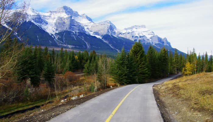
The Icefields Parkway is considered one of the most spectacular drives in the world. This double-lane highway stretches for 233 km between Lake Louise and Jasper, past snow-capped peaks and icefields, through vast valleys and along rivers. The Icefields Parkway is runnable, since there’s a good shoulder along both sides. But it is a highway, with a steady stream of fast-moving vehicles. This “Summer Visitor Guide” has a great map describing the Parkway’s highlights (pp. 16-19), with distances and elevation profiles. Note: Can be closed for stretches of time in winter.
Practically any section of the Parkway is gorgeous for running. Here are some of the most scenic sections for running (using km markers, north from Lake Louise, and south from Jasper):
Between Bow Lake(39/194) and Bow Summit/Peyto Lake (43/190). At Bow Lake, a very pretty section of road along the lake for 2-3 km, with views to Crowfoot Glacier and the Cirque mountain. Includes a gravel side path along the lake for a bit, and the ~1 km Field Rd off the Parkway. It’s uphill, north for ~5 km from Bow Lake to Bow Summit. At Bow Summit, a side road (quieter for running!) leads toward Peyto Lake, with great mountain views.
Saskatchewan River Crossing (79/154). Area around intersection of Highway 11, nice river and mountain views.
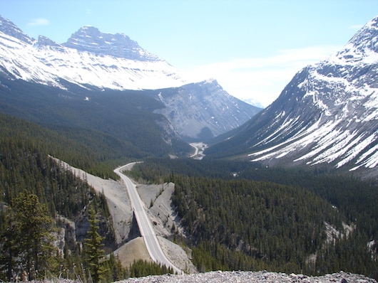
Between Big Hill/Big Bend (115/118) and Icefield Center (130/103). This 15 km stretch is among the most spectacular stretches for running. Gorgeous section of road, with walls of mountains offering great valley views. HILLY! Descending heading north, and ascending heading south. Near the Parker Ridge Trailhead, there’s a side road that goes for 4 km that gets you away from traffic. At Icefield Center, great views of the Columbia Icefield from the road, and a 1 km road from the Parkway heading up toward the glacier.
Between Sunwapta Falls (177/56) and Athabaska Falls (203/30). This is a 25 km stretch of road. Particularly nice in the valley along the Athabaska River, in Kerkeslin, for ~6-7 flat km. Nice mountain views in the Sunwapta Falls area.

Comment on this Route/Share a Photo!
Share your feedback on this route and see that of other Great Runs users. Click on the image icon to upload a photo. And please let us know if there are notes or changes we should incorporate!