Features:
Categories:
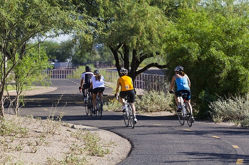
Tucson has a growing network of bike paths and bike lanes, which make for some good running downtown. In another post, we recommended the best running in the downtown area and around the University campus.
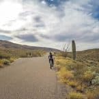
The Chuck Huckelberry Loop is a series of paved multi-use paths that form a 131-mile circuit around Tucson and the surrounding suburbs. It’s still a work in progress, but runners can hop on at several points close to downtown. Here are some of our favorites. Link to map below.
Tucson Bike Path MapSanta Cruz River Park Shared Use Path. Just west of I-10 and easily accessible from downtown (Congress St.). Goes north-south, paralleling I-10. Also connects to “A Mountain”. In north, near the Rillito River Path. Goes on for many miles.
Rillito River Path. 7 miles north of downtown. 10 mile east-west path. See separate post.
Golf Links-Aviation Shared Use Path. Parallels Aviation Parkway and then Golf Links Rd., heading southwest from downtown to the Golf Links sports complex, about 7 miles one way. From downtown, easily accessible from 4th Ave. & 9th St.
Old Spanish Trail. 5 mile, paved path adjacent to westbound Old Spanish Trail between Broadway and Freeman. Path ends at Saguaro National Park East entrance, so a nice add-on.

Comment on this Route/Share a Photo!
Share your feedback on this route and see that of other Great Runs users. Click on the image icon to upload a photo. And please let us know if there are notes or changes we should incorporate!