Features:
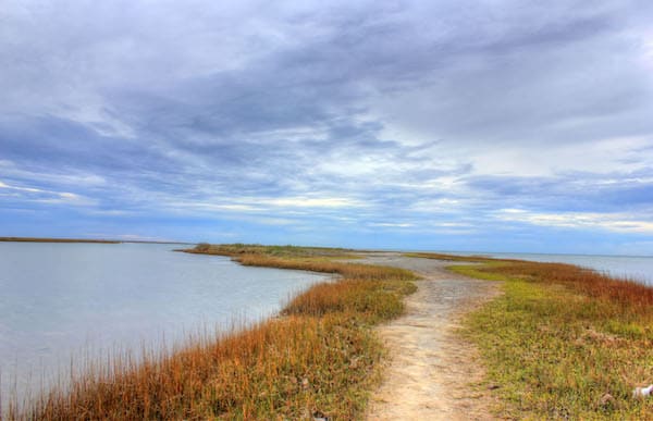
Galveston Island State Park is one of the best opportunities for a run away from the roads and crowds. Straddling both the beach and bay sides, the park has 4 miles of trails that are suitable for running. There are lovely views of the beach, bay, wetlands, and coastal prairie. This website has good information on the park, and an interactive trail map.
The park is located about 10 miles southwest of central Galveston. The 4 miles of trails are overlapping, so you’ll have to combine them to get in a decent run. The longest trail is ‘beach to bay’ Heron’s Walk Trail, at 1.4 miles out and back. The attached trail map has excellent descriptions of the trails. Do a duathlon and enjoy some of the paddling trails!
Add-ons. The beach is runnable in this area. The main road, Termini-San Luis Pass Rd., is OK but not great for running — there are some water views, but the road can be busy and has a narrow shoulder.
- About 4 miles of trails suitable for running. Beach is also good for an add-on
- Flat
- Depends on trail chosen
- Numerous parking areas -- see map. The park is 10 miles southwest of central Galveston

Comment on this Route/Share a Photo!
Share your feedback on this route and see that of other Great Runs users. Click on the image icon to upload a photo. And please let us know if there are notes or changes we should incorporate!