Features:
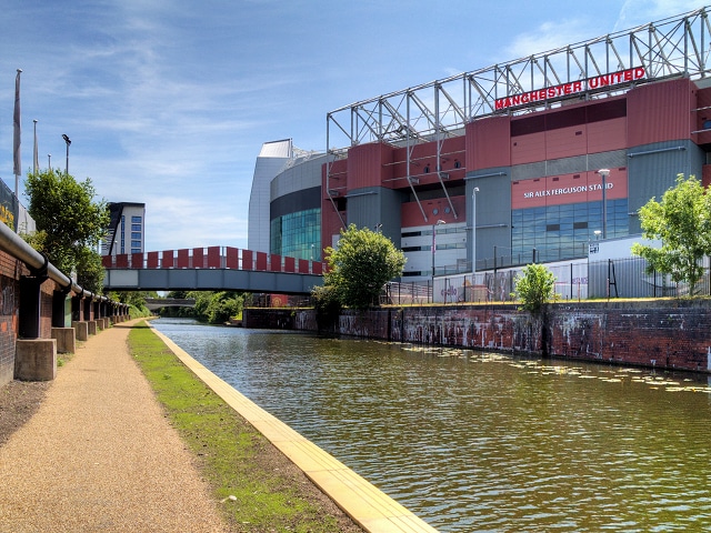
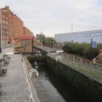
There are several canal path options in Manchester. Bridgewater Way/Bridgewater Canal Tow Path heads south from Castlefield Basin, for several miles. We’ve mapped 4.75 miles, between Castlefield Basin and the M60/River Mersey Intersection. A good 4 mile out and back is to run to Manchester Stadium/Old Trafford — where the famous Manchester United plays — and return. There are good water views most of the way. The surface alternates between pavement and some cobblestone, and is sometimes at street level and other points below grade. Some key distances are indicated below. A good detour/add-on is to head over to the Quays, using Trafford Rd. Note: it does look like there is a path on the northern side of the canal, but it is not that well maintained — we recommend staying on the southern side.
- 2.0m: Manchester Stadium/Old Trafford
- 2.9m: Trafford Park train station
- 4.5m: Turn Moss Playing Fields– good paths for running
- Up to 4.75 miles one-way
- Flat
- Castlefield Basin or other spots on path
- Castlefield Basin is centrally located. Deansgate train station, Convention Center

Comment on this Route/Share a Photo!
Share your feedback on this route and see that of other Great Runs users. Click on the image icon to upload a photo. And please let us know if there are notes or changes we should incorporate!