Features:
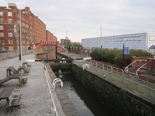
This is the signature canal path run in Manchester. One can run 30+ miles from Manchester to the Sowerby Bridge in Yorkshire! We’ve mapped nearly 5 miles from Castlefield Basin to Oldham Rd. The surface is gravel most of the way and pleasant for running. Some sections are at street level, others are below grade. There are good water views. There are some lovely sections, with good variety, from commercial areas to residential spots, and then a little more rural. The first 1-2 miles pass through central Manchester, and the path gets more pastoral as it heads out of the city. A good 4-mile out and back is to Victoria Mill Park. Just past Ring Rd., there is a nice connection to the Ashton Canal Tow Path at New Islington Arena. That path goes 2 miles to Philips Park.
Some key distances, below — starting from Castlefield Basin.
- 0.7m: Alan Turing Memorial
- 1.0m: Ducie St. – Ashton Canal Tow Path
- 1.2m: A665 Ring Rd.
- 2.0m: Victoria Mill Park
- 2.4m: A6010/Alan Turing Way. Near Philips Park/Clayton Vale
- 3.8m: Droylsden Rd./Brookdale Park
- 4.9m: Oldham Rd.
- 4.9 miles one-way. A good 4-mile out and back is to Victoria Mill Park
- Flat
- Castlefield Basin. Canal St. & Princess St is another good starting point
- Good access and transoport in central Manchester

Comment on this Route/Share a Photo!
Share your feedback on this route and see that of other Great Runs users. Click on the image icon to upload a photo. And please let us know if there are notes or changes we should incorporate!