Categories:
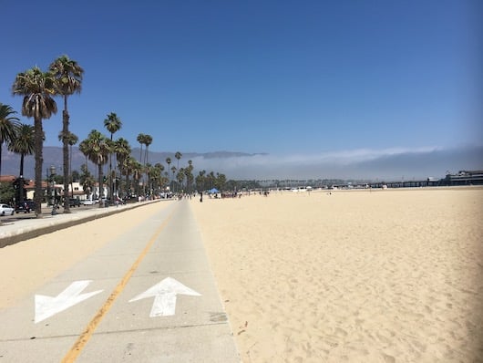
The signature Santa Barbara run is between Shoreline Park and East Beach, featuring beaches, marina, piers, parks, palm-lined boulevards, mountain views, and more! The total distance is nearly 5 miles one-way, mainly following multi-use paths. Starting from Shoreline Park and heading south, you’ll reach the Harbor, which has a nice 0.5 mile jaunt out to Point Castillo. Return to the main path and continue along palm-lined Cabrillo Blvd. to Stearns Wharf, and run out to the pier. From there, it’s another 1.5 miles to east beach, with the Pacific on one side, and mountains to the east. This is an easy run to join at any point and vary the distance. The beach is also very runnable, depending on tides. Regular shuttles along Cabrillo allow for one-way options. Key distances, starting from Shoreline Park:
1 mile from Shoreline Park to Leadbetter Beach
0.3 miles from Leadbetter Beach to Santa Barbara Harbor (marina)
[1 mile out and back along the Harbor/marina to Castillo Point]
0.5 miles from the Harbor to Stearns Wharf (0.5 miles out and back to end of pier)
1.5 miles from Stearns Wharf to the end of East Beach (path turns inland)
Add-On: Montecito Loop. From the south end of the waterfront route, run 1 mile inland on Cabrillo to Channel Dr. and enjoy a spectacular 1 mile along the coast in Montecito, featuring the Four Seasons Biltmore & spectacular homes. Make a loop of it in order see the famous Coast Village road and Butterfly Beach, using Butterfly Ln. and Olive Mill Rd. to cross Highway 101.
Also, North of Shoreline Park is Hendry’s Beach and the exclusive Hope Ranch neighborhood.
- 4.9 miles one-way (includes Castillo Point & Stearns Pier). Can be easily shortened and joined at any point
- flat
- At any point. North end is Shoreline Park, South end is East Beach
- Shuttles run along Cabrillo Blvd.


Comment on this Route/Share a Photo!
Share your feedback on this route and see that of other Great Runs users. Click on the image icon to upload a photo. And please let us know if there are notes or changes we should incorporate!