stpaulrealestateblog.com
Features:
Categories:
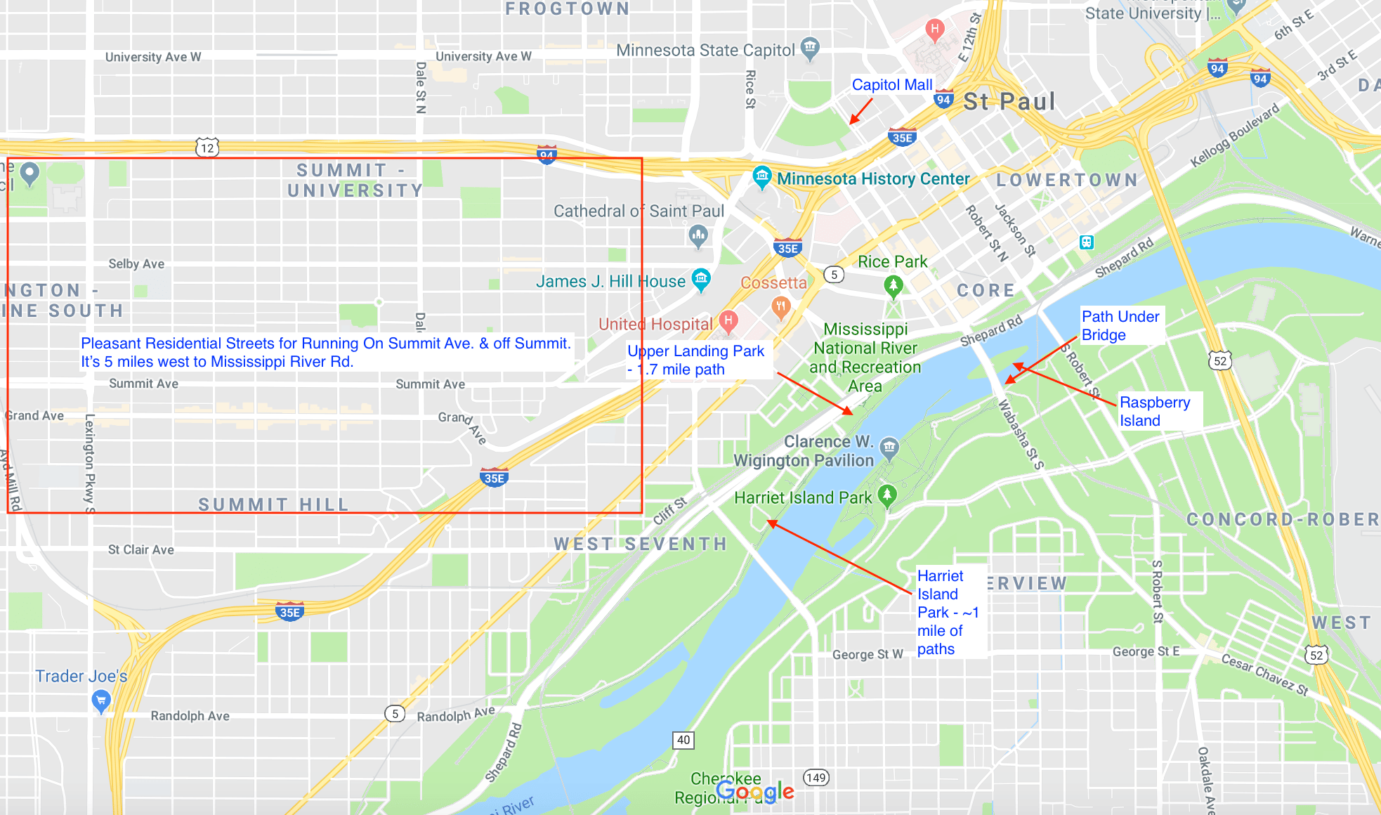
The area around downtown St. Paul has an interesting geography: a grand Capitol building, several bridges spanning the Mississippi River, and a series of islands and river paths below the bridges administered by the National Park Service. It’s beautiful, but a bit of a tangle, so rather than design a specific route, here’s our guide to best running spots in the area. See our attached map.
- Capitol. Pleasant run along the ‘Mall’ to the Capitol from WWII Memorial, or use John Ireland Blvd. Just to the east, run by the Cathedral of St. Paul, and pleasant residential streets such as Summit Ave. and off Summit.
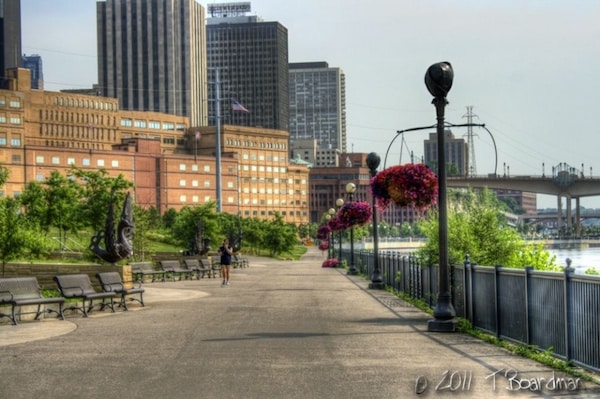
- National Recreation Area. Thee is nice riverfront running under the bridges. From the Visitor Center off Kellogg Blvd., Upper Landing Park on the north side offers a lovely 1.7 mile one-way run along the water to Shepard Rd. There is also a path under the Wabacha St. Bridge, onto Raspberry Island and in Harriet Island Park on the south side, which has paths running for ~1 mile to Kelly Landing. You can retrace your steps or go a bit further to the Robert St. Bridge, and run along Kellogg Mall Park back to the Visitor Center. This is a 6.5 mile run.
Essentials
- Multiple options. We've put together a 6.5 mile loop involving the river paths and bridges
- 180 feet
- For river paths, the Visitor Center is a good spot to start
- Light Rail serves downtown St. Paul.


Comment on this Route/Share a Photo!
Share your feedback on this route and see that of other Great Runs users. Click on the image icon to upload a photo. And please let us know if there are notes or changes we should incorporate!