Features:
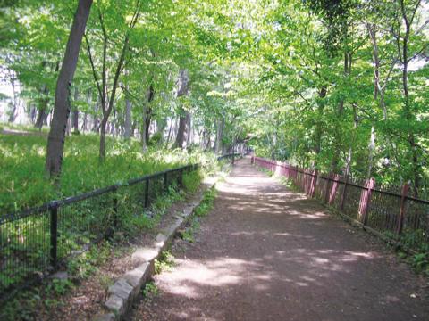
The Tamagawajosui is an aqueduct built as a drinking water supply from the Tama River, completed in 1653. There is a tree-lined dirt path that runs along the canal, about 40k. It starts near the Hajima station in Tokyo’s western suburbs to Shinjuku station in central Tokyo.
We have mapped a 26 mile section of the trail between between Hajima station and Waseda University, near the Edogawabashi Station. The most pleasant and popular sections are the 15k between Hajima to just east of Koganei Park, Tanashi (Seibu Shinjuku line) and Musashi Sakai (JR Chuo line). It’s another 5k to Inokashira Park. For those running in Koganei Park, this is a nice opportunity to extend the run.
Essentials
- 26.2 miles
- Fairly flat - only 316 feet elevation gain over 26 miles
- Hajima station is westernmost point, Shinjuku is easternmost
- Hajima station is westernmost point, Shinjuku is easternmost

Comment on this Route/Share a Photo!
Share your feedback on this route and see that of other Great Runs users. Click on the image icon to upload a photo. And please let us know if there are notes or changes we should incorporate!