Features:
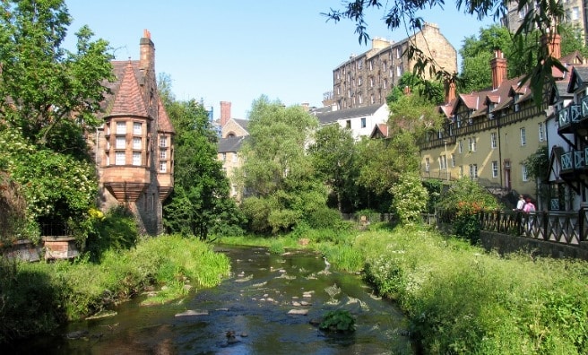
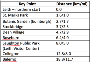
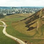
The Water of Leith is a canal-side path that goes about 12 miles between Leith and Balerno. Leith is on the water, about 2 miles north of Edinburgh. It is a very pleasant path for a run. Combination of paved and gravel, and fairly easy to follow. The walkway passes through many areas of interest including: Colinton Village and Dell, the Union Canal, Saughton Winter Gardens, Murrayfield Stadium, the Scottish Gallery of Modern Art, Dean Village, Stockbridge, the Royal Botanic Garden and Leith. The closest pass to central Edinburgh is Royal Botanic Garden, about 2km west of the city center. The southwestern end of the path, in Balerno, is just west of Pentland Hills Regional Park. There’s a visitor center in Saughton. See table for key disrances.
Note: Consult website – there are periodic trail closures and public works.
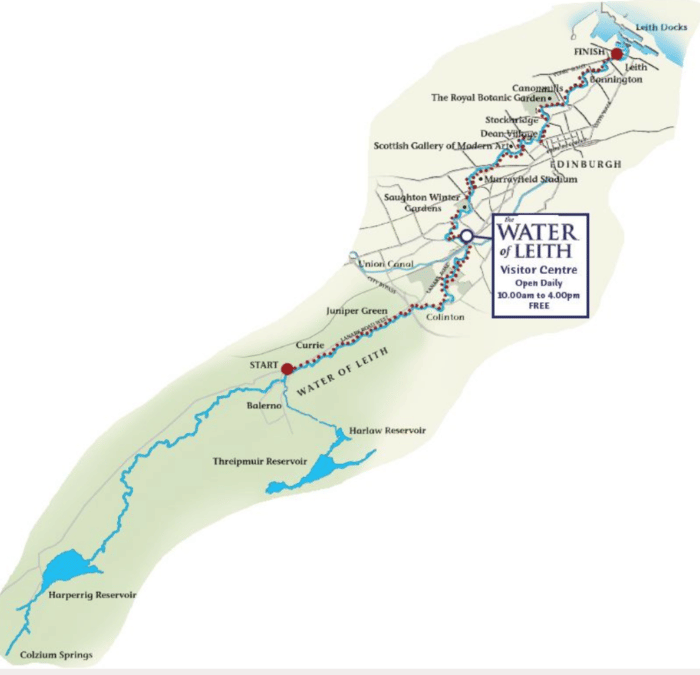
- About 19 km (12 miles) one way
- 680 feet over 12 miles
- Northeast Start: Center of Leith, Commercial St.; Southwest end: Balerno.
- Multiple Access Points. Closest pass to central Edinburgh is 2km west at Botanical Garden

Comment on this Route/Share a Photo!
Share your feedback on this route and see that of other Great Runs users. Click on the image icon to upload a photo. And please let us know if there are notes or changes we should incorporate!
From my house to Balerno and back along the Water is exactly 20k and I run it a couple of times a week, sometimes taking a route from Balerno up to Harlaw and Clubbiedean reservoirs as the return. Great run indeed, you can get from the city centre to tree lined small country river in minutes and its never busy.