Features:
Categories:
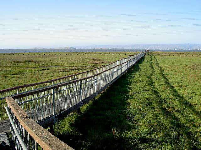
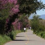
On the eastern shore between Palo Alto and San Jose, there is a remarkable series of trails and parks overlooking the Bay. Several of these trails incorporate a series of undisturbed tidal marshland (Sloughs) called the Baylands. The trails are a combination of paved and unpaved, and are wonderful for walking and running. It’s a combination of running along the Bay, out along the levees of the sloughs, and through some pleasant parks. This is also among the best bird-watching areas on the west coast. Keep an eye out for the gorgeous white pelicans! Note that several major high tech company HQ, such as the Googleplex, sit between the I-101 and the Baylands trails.
It is impossible to describe any one or two particular runs in the Baylands. There are three main sections of these trails, each described below: East Palo Alto; Mountain View (near Google and NASA); and toward San Jose (the Alviso trails). The “Bay Trail” is an anchor but is not seamless. Below, from north to south, we have described some of the best options for running. The closest section to San Jose the Alviso Trails, 8 miles east.
Palo Alto Baylands
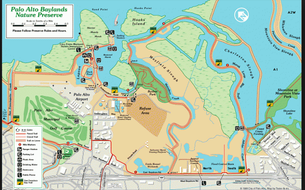
Only 2.5 miles from downtown Palo Alto and right off the 101. Below are a couple of good options. Also, connect to other trails here, such as the San Francisco Creek Trail, which goes around the Palo Alto golf course. A section of the Bay Trail heads west toward the Ravenswood Open Space Preserve.
- Adobe Creek Loop Trail 5.0 miles. A great 5 mile loop. Best Baylands run close to Palo Alto. MAP
- Shoreline Park. Lovely 3.7 miles ONE-WAY, from intersection of Bay Trail & Adobe Creek Trail to the eastern end of Stevens Creek and the Jogel Slough. Shoreline Park has a cool kite field. Near Google. MAP
Mountain View Section (near Google)
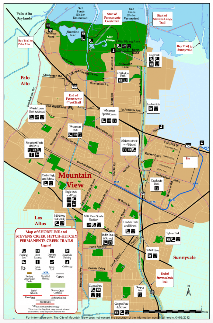
There are great options in this area, close to many corporate HQ, hotels, Levi’s Stadium, and the Santa Clara Convention Center.
- Bay Trail 6 miler. LOOP, runs along shore/slough and Moffet Channel. MAP
- Stevens Creek Trail. Nearly 5 mile trail that runs parallel to Rt. 85., from just west of El Camino Real (Rt. 82) all the way to the Bay. A good option near downtown Mountain View. Connect to other trails in the Baylands area. MAP
- Moffett Loop. Good quick 3-mile loop around Moffett Channel. MAP
- Moffet Field Bay Trail. Section along the bay near Stevens Creek. 2.25 miles one way. MAP
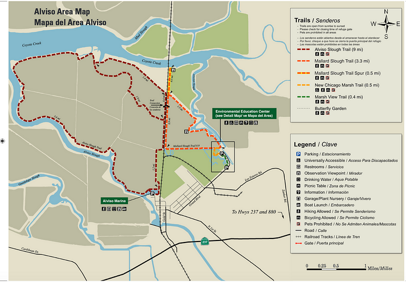
Sunnyvale/San Jose Section
- Sunnyvale Baylands Park is your best bet for a quickie run right off Great America/Tasman, near the stadium and many corporate HQ. Connects to Bay Trail. Park Map.
- Saratoga Creek has a nice jogging trail. Trail Info.
- Alviso Park. 8 mile loop. Nice trails in this area, only 2.5 miles from Santa Clara Convention Center, Levi’s Stadium. We’ve mapped an 8.8 mile loop around Alviso Slough. There are other nice trails heading west toward Coyote Creek, and the 30,000 acre National Wildlife Refuge. MAP
- Various Distances depending on route
- These trails are generally flat
- Parking available in most of these areas

Comment on this Route/Share a Photo!
Share your feedback on this route and see that of other Great Runs users. Click on the image icon to upload a photo. And please let us know if there are notes or changes we should incorporate!