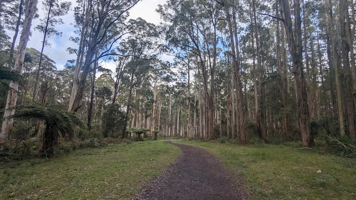
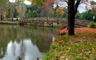
Also part of Dandenong Ranges National Park, the 800 hectares of bushland and wet temperature rainforest in Ferny Creek provide countless trails, with options for runners of all abilities. The area is famous for lyrebirds and the conservation of the species. There are two main trail heads: Sherbrooke Picnic Ground and Grant’s Picnic Ground.
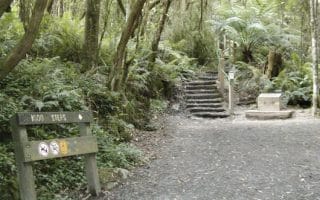
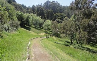
Sherbrooke Picnic Ground. This route starts with a descent before climbing between km 3 and and km 5 kilometre marks and finishing flat. Follow Sherbrooke Track from the Sherbrooke Picnic Ground before going left onto Odonohue Track just before the 1 km (0.62 mile) mark. Take the next left, to descend down Hill climb Track and right at the bottom to start the climb up Pound Creek Track. Follow this track before joining Edgebrook Track, Hackett Track, and Monument Track before re-joining Lloyds Track to get back to the start. Access: Our preferred parking is the Alfred Nicholas Memorial Garden carpark on Sherbrooke Rd., as it is generally easier to find a spot. Lloyds track is nice single track that links Alfred Nicholas Memorial Garden Carpark and Sherbrooke Picnic Ground and can act as a warmup.
Grant’s Picnic Ground. The Grant’s Picnic Ground carpark is off Monbulk Road, which splits Sherbrooke Forest in two. Similar to the Sherbooke Picnic Ground loop, this route starts with a descent before climbing back up to the starting point. Behind the roundabout, head down Lyrebird Walk before veering right onto Neuman Track. Another right before 2 km (1.2 miles) down Paddy Track which you follow as it turns into Welch Track then Coles Ridge Track as you start the climb. Coles Ridge Track can be followed all the way back to the start, or alternatively (as our route shows), go left onto Lipscombe Break after 4.5 km (2.8 miles), then follow onto Bleakley Track until you reach the Grant’s Picnic Ground again.
Jonah’s Loop. This is a 16 km loop recommended by Jonah G. It combines elements of the above two routes and is more of a perimeter loop. The trail is fairly wide, with decent footing. VERY HILLY, with an elevation gain of 750m.
Also part of Dandenong Ranges National Park, the 800 hectares of bushland and wet temperature rainforest in Ferny Creek provide countless trails, with options for runners of all abilities. The area is famous for lyrebirds and the conservation of the species. There are two main trail heads: Sherbrooke Picnic Ground and Grant’s Picnic Ground.
Sherbrooke Picnic Ground. This route starts with a descent before climbing between km 3 and and km 5 kilometre marks and finishing flat. Follow Sherbrooke Track from the Sherbrooke Picnic Ground before going left onto Odonohue Track just before the 1 km (0.62 mile) mark. Take the next left, to descend down Hill climb Track and right at the bottom to start the climb up Pound Creek Track. Follow this track before joining Edgebrook Track, Hackett Track, and Monument Track before re-joining Lloyds Track to get back to the start. Access: Our preferred parking is the Alfred Nicholas Memorial Garden carpark on Sherbrooke Rd., as it is generally easier to find a spot. Lloyds track is nice single track that links Alfred Nicholas Memorial Garden Carpark and Sherbrooke Picnic Ground and can act as a warmup.
Grant’s Picnic Ground. The Grant’s Picnic Ground carpark is off Monbulk Road, which splits Sherbrooke Forest in two. Similar to the Sherbooke Picnic Ground loop, this route starts with a descent before climbing back up to the starting point. Behind the roundabout, head down Lyrebird Walk before veering right onto Neuman Track. Another right before 2 km (1.2 miles) down Paddy Track which you follow as it turns into Welch Track then Coles Ridge Track as you start the climb. Coles Ridge Track can be followed all the way back to the start, or alternatively (as our route shows), go left onto Lipscombe Break after 4.5 km (2.8 miles), then follow onto Bleakley Track until you reach the Grant’s Picnic Ground again.
Jonah’s Loop. This is a 16 km loop recommended by Jonah G. It combines elements of the above two routes and is more of a perimeter loop. The trail is fairly wide, with decent footing. VERY HILLY, with an elevation gain of 750m.


Review or Comment on This Route/Share a Photo!
Share your feedback on this route and see that of other Great Runs users. Click on the image icon to upload a photo. And please let us know if there are notes or changes we should incorporate!