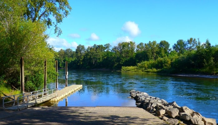
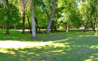
The most accessible running route in Corvallis is the waterfront path along the Willamette River, which runs right through downtown. There is a roughly one mile concrete path that travels along First Street and through Riverfront Commemorative Park, with water views in some sections. For more mileage, runners can turn west along the Mary’s River (just past the highway interchange) and continue into Pioneer Park and Avery Park. The groomed pathways here add a pleasant additional 2 miles. The resulting “lollipop” route that we’ve mapped is a total of 5 miles. Runners should also note that there are a few short paths in the Orleans Natural Area on the east bank of the river.
Rick Obst
Features:
Categories:
Scroll Down For Route Maps
Essentials
- Up to 5 miles (8.3 km) out and back
- 81 feet (24m)
- First Street
- First Street
Current Weather & Forecast

Corvallis, US
5:16 pm,
Jun 3, 2026
L: 18°
H: 21°
Daily ForecastHourly Forecast
Tomorrow
2:00 pm
18° / 21°°C
1 mm
100%
19 mph
85 %
1002 mb
0 mm/h
Friday
2:00 pm
11° / 18°°C
0.9 mm
90%
11 mph
92 %
1016 mb
0 mm/h
Saturday
2:00 pm
10° / 19°°C
1 mm
100%
10 mph
94 %
1015 mb
0 mm/h
Sunday
2:00 pm
13° / 18°°C
1 mm
100%
13 mph
97 %
1021 mb
0 mm/h
Monday
2:00 pm
11° / 20°°C
0.71 mm
71%
12 mph
86 %
1020 mb
0 mm/h
Today
8:00 pm
15° / 15°°C
0 mm
0%
12 mph
85 %
999 mb
0 mm/h
Today
11:00 pm
16° / 16°°C
0.32 mm
32%
13 mph
79 %
999 mb
0 mm/h
Tomorrow
2:00 am
18° / 18°°C
1 mm
100%
15 mph
80 %
998 mb
0 mm/h
Tomorrow
5:00 am
16° / 16°°C
1 mm
100%
13 mph
82 %
998 mb
0 mm/h
Tomorrow
8:00 am
18° / 18°°C
1 mm
100%
19 mph
57 %
999 mb
0 mm/h
Tomorrow
11:00 am
18° / 18°°C
0.76 mm
76%
15 mph
63 %
1000 mb
0 mm/h
Tomorrow
2:00 pm
16° / 16°°C
0.32 mm
32%
9 mph
84 %
1002 mb
0 mm/h
Other Routes in Corvallis, OR
For short easy runs in the south of the city, look no further than Willamette Park and Natural Area, the city’s largest green space. A loop around the park and the gravel path headed south is ~4 miles.
This landscaped campus features many sidewalked streets and pedestrian paths, lined with trees and stately brick buildings, and is a designated Historic District. Can be add-on to the Bald Hill Nature Area/Willamette River Path.
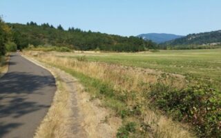
Gorgeous valley views at this 285-acre nature park near OSU. Gravel trails switchback their way around Bald Hill, which can be combined with a 1.5 mile flatter multi-use path.
A good trail running option close to town with rolling hills through forest and meadow. Connect to the Timber Hill neighborhood or Lester Ave for road running extensions, or continue onto the more rugged trails of McDonald-Dunn Forest.
The Oregon State University’s research forest has miles of runnable public trails as well as access to the McDonald-Dunn Forest trail network.
User Ratings
Leave A Review or Comment
Review or Comment on This Route/Share a Photo!
Share your feedback on this route and see that of other Great Runs users. Click on the image icon to upload a photo. And please let us know if there are notes or changes we should incorporate!