Features:
Categories:
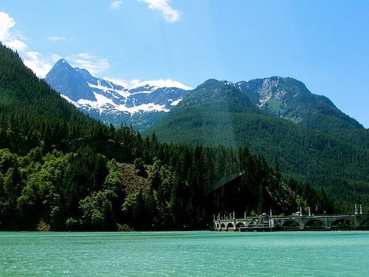
North Cascades National Park, located less than three hours from Seattle, offers a stunning and diverse alpine landscape. There are jagged peaks crowned by 300 glaciers, forested valleys, and open grassland. The terrain varies between the moister western section and the drier eastern section. In terms of running in North Cascades National Park, most of the park’s 400 miles of trails are more challenging hiking/trail running. However, there are a few great places to run in North Cascades National Park, particularly in the Stehekin section. Note: Winters in this area are wet and can feature heavy snowfall.
STEKEHIN AREA (Lake Chelan National Recreation Area)
A spectacular, unique area with stunning lake and mountain views, accessed by a ferry ride across the 55-mile Lake Chelan fjord. No road access. From Stekehin village, there’s wonderful running along Stekehin Valley Road, and some other trails that are good or running. STEKEHIN AREA MAP FERRY INFO
Stekehin Valley Road

Stekehin Valley Road is one of the more spectacular running experiences in the National Park system. There are fantastic views of Lake Chelan (third deepest lake in the United States) and surrounding mountains. The gravel road is generally a good surface, and goes for 13 miles between Stehekin Landing and Carwash Falls. The first 6 miles through the lower valley is generally flat and the best option for the everyday runner. It’s 3.6 miles to Buckner Orchard, 4 miles to Harlequin Bridge. After 6 miles, it’s a steady climb to High Bridge (11 miles), and the final 2 miles are quite steep and challenging. ROUTE MAP (One-Way)
Other Good Trails for Running in Stekehin
Lakeshore Trail. Accessed from Stekehin Landing. Following the scenic north shore of Lake Chelan for up to 17 miles, this is easy to moderate trail running. Ideal for early morning and evening walks. Great panoramic view of McGregor Mountain at one mile. It’s 3.5 miles to Flick Creek and 7 miles to Moore Point.
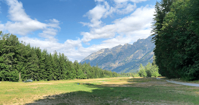
Shekehin River Trail. Up to 4 miles one-way from the airstrip to Weaver Point. Slightly tougher footing but generally level. Nice wildflowers.
North Cascades National Park Trails
Most of the park’s 400 miles of trails are more challenging, rugged trail running. Mile Posts are off SR 20. A few easy-to-moderate options:
Thunder Creek Trail. Mile Post 130. Follows a cloudy-blue, glacier-fed creek through ancient forests to the heart of the park. The first two miles to the the first bridge are an easy walk/run. After that it gets more strenuous.


Comment on this Route/Share a Photo!
Share your feedback on this route and see that of other Great Runs users. Click on the image icon to upload a photo. And please let us know if there are notes or changes we should incorporate!