A series of regional parks about 10 miles east of Anaheim offer lots of green and some terrific running options. A great mix of riverfront paths, nature trails, wooded paths, and some trail running choices in the hilly canyons. A summary from north to south:
Carbon Canyon Regional Park. Lovely park 11 miles northeast of Anaheim, with some nice trails through developed areas and a 1.1 mile trail to Orange County’s only grove of redwoods.
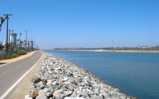
Yorba Regional Park. This 1-mile linear park consisting of four lakes with connecting streams, and some interior trails. The Santa Ana River Trail also passes through this park, heading 20 miles southwest to the ocean.
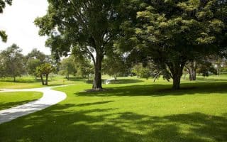
Irvine Regional Park. Pleasant 475-acre park with several miles of trails nestled among a grove of heritage Oak and Sycamore trees. Small pond. Combination of paved and dirt pathways. Best bet for an easy-to- follow longer run is the 4-mile equestrian loop. Other good options are the 3.2 mile Horseshoe Loop Trail, which has a nice scenic overlook at its northern end, and the 1.3 mile Road Runner loop, which heads toward Santiago Oaks Regional Park, which has several miles of more rugged trails.
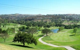
Peters Canyon Regional Park. Nice mix of graded road and trails through coastal sage scrub, riparian, freshwater marsh and grassland habitats. Quite open, and some good hills. Best bets for running are the 2.5-mile Lake View Loop and the 2-mile Peters Canyon Trail.
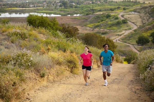
More rugged, hilly hiking and trail running can be found in Deer Canyon Park and Santiago Oaks Regional Park/Anaheim Hills Riding and Walking Trail.
A series of regional parks about 10 miles east of Anaheim offer lots of green and some terrific running options. A great mix of riverfront paths, nature trails, wooded paths, and some trail running choices in the hilly canyons. A summary from north to south:
Carbon Canyon Regional Park. Lovely park 11 miles northeast of Anaheim, with some nice trails through developed areas and a 1.1 mile trail to Orange County’s only grove of redwoods.
Yorba Regional Park. This 1-mile linear park consisting of four lakes with connecting streams, and some interior trails. The Santa Ana River Trail also passes through this park, heading 20 miles southwest to the ocean.
Irvine Regional Park. Pleasant 475-acre park with several miles of trails nestled among a grove of heritage Oak and Sycamore trees. Small pond. Combination of paved and dirt pathways. Best bet for an easy-to- follow longer run is the 4-mile equestrian loop. Other good options are the 3.2 mile Horseshoe Loop Trail, which has a nice scenic overlook at its northern end, and the 1.3 mile Road Runner loop, which heads toward Santiago Oaks Regional Park, which has several miles of more rugged trails.
Peters Canyon Regional Park. Nice mix of graded road and trails through coastal sage scrub, riparian, freshwater marsh and grassland habitats. Quite open, and some good hills. Best bets for running are the 2.5-mile Lake View Loop and the 2-mile Peters Canyon Trail.
More rugged, hilly hiking and trail running can be found in Deer Canyon Park and Santiago Oaks Regional Park/Anaheim Hills Riding and Walking Trail.

Review or Comment on This Route/Share a Photo!
Share your feedback on this route and see that of other Great Runs users. Click on the image icon to upload a photo. And please let us know if there are notes or changes we should incorporate!