Features:
Categories:
Angers is a lovely town on the Maine River at the western edge of the Loire Valley. Some of the best running in Angers features an extensive network of paths that run alongside the Maine, several tributaries, and the Loire River, which is just to the south. There are many km of options – here are some recommendations.

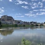
Maine & Mayenne River – Northeast. From the center of Angers at Parc Balzac, there are lovely, fairly narrow gravel paths along both sides of the Maine River headed east, with good water views. We prefer the north side. After ~3 km, at a split, you have choices: continue north along the Mayenne River for up to 4.7 km to the D107, or take the Sarthe option (below). Both paths become pleasantly pastoral only a couple of km east of Angers center.
- Sarthe River Option. At the split, continue northeast along the Sarthe River for ~4 km to Ecouflant. Note that for the Sarthe option, take the Pont Confluence pedestrian bridge to the southern side of the Maine.
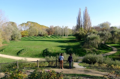
Maine River – South. Another option is to run southwest along the Maine, on similarly lovely paths. From Parc Balzak, the first 3 km are along Lac de Maine (lake), and then the path continues for another 5 km to Bouchemaine. At 3.6 km is the Pont de la Liberation (good crossing to south side path), at 4.6 km is an Observation Deck, and at 6.5 km the D112.
- Maine River: From Parc Balzac it's 3.3 km east to the split, or 8 km southwest; Mayenne River section is 4.7 km; Sarthe is 4 km.
- Flat
- Parc Balzac/central Angers, or other preferred point!
- Numerous access points


Comment on this Route/Share a Photo!
Share your feedback on this route and see that of other Great Runs users. Click on the image icon to upload a photo. And please let us know if there are notes or changes we should incorporate!