
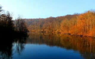
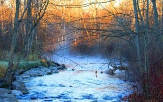
The Huron River, which flows through the heart of Ann Arbor, is surrounded by some of the loveliest green spaces in the city. While the paths along the river banks are somewhat fragmented (i.e. not continuous), there are a couple of choice parks which can be connected to make for a substantial waterfront run.
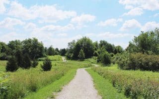
Gallup Park, on the east end of the city, is one of Ann Arbor’s most popular recreation areas, spread out over 69 acres. The main paved path circles Geddes Pond for about 0.5 miles, but a larger loop is 1.7 miles. which can be added to by running the paths of the Furstenberg Nature Area, immediately west, or Ruthven Nature Area, immediately north. It’s one of the flatter parks in Ann Arbor for running, and well maintained during the winter snow season. Gallup Park Pathway MAP.
Longer Run: Head east on the the Gallup Park Pathway for 1.6 miles towards Parker Mill County Park where it connects with the Matthei Botanical Gardens Trail. West of Gallup Park, the path goes for 1.5 miles to the Nichols Arboretum at the University of Michigan.
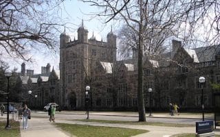
The Nichols Arboretum (aka The Arb) is a great run in and of itself, with groomed dirt paths circling the gardens for about 2.5 miles, and plenty of cross-trails to explore. Runners can also use the Gallup Park Path and the Matthei Botanical Gardens Trail to connect to the Arboretum’s sister gardens on North Dixboro Road. The Arboretum is open sunrise to sunset seven days a week, and the Matthei Botanical Gardens are open 10 am until 4:30 pm daily, except Wednesdays when they are open until 8. Admission to both parks is free and open to the public. Nichols Arboretum MAP.
Both Gallup Park and the Nichols Arboretum are located along the Border-to-Border (B2B) Trail, a 40 mile multi-use path through Washtenaw County. The complete paved, off-road section of the B2B starts from Eastern Michigan University in the east. From here, it runs west past Gallup Park, Nichols Arboretum, Riverside Park, Argo Park, and Bandemer Park for a one-way of over 9 miles. B2B Trail MAP.

Review or Comment on This Route/Share a Photo!
Share your feedback on this route and see that of other Great Runs users. Click on the image icon to upload a photo. And please let us know if there are notes or changes we should incorporate!