Features:
Categories:
Assateague Island is a beautiful refuge of sandy beaches, salt marshes, maritime forests and coastal bays, located only 10 miles south of Ocean City. The Island is protected, as a National Seashore and State Park, and includes Assateague in Maryland and Chincoteague National Wildlife Refuge in Virginia (which are 50 miles apart, by car!). There are some good running options here, including the extensive beach, several paved bicycle and walking paths, and some more rugged trails. Note that some of the non-paved trails might be sandy. A few running highlights:
Assateague Island
Verrazano Bridge and Bayberry Drive Path. Starting from the Visitor Center, a gorgeous multi-use path
parallels the Verrazano Bridge to Assateague Island. Runners can continue on 4 miles of paved bike path along Bayberry Dr. (mile markers every 1/4 mile). The scenery here is mainly dunes and grassland. You can add on with the short, 1/2 mile loops on Life of the Dunes Trail (softt sand), Life of the Forest Trail, and Life of the Marsh Trail. A trail continues south of the Life of the Dunes trail for many miles, but it can be sandy for running. TRAIL MAP
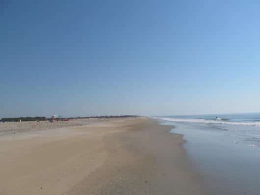
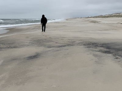
Beach Running. On Assateague, runners will love the miles and miles of beach. At the northern end is the 2 miles of beach administered by Assateague State Park, which then spills into the many miles of beach administered by the National Park Service. The sand is compact near the water, especially near low tide — best to consult a tide chart.
Chincoteague Island
The Chincoteague National Wildlife Refuge has several scenic trails that are terrific for running. One great 5-mile route is to combine the bike path from the Chincoteague Island Museum, over the bridge to the island, and then take the Marsh Trail and the Wildlife Loop. For a nearly 9-mile run, add the Beach Access Rd. and the Woodland Trail. For specific trail loops, there’s the 3.25-mile paved Wildlife Loop, which can be combined with the paved 1-mile Black Duck Trail and 1.6 mile paved Woodland Trail, which winds through a pine forest. For a longer run, the 7.25 mile Service Road is a gravel path, closed to cars, passing through forest, shrub/thicket and wetland habitats.
The beach is also wild, undeveloped, and gorgeous for running. There sand is firm and compact near the water, especially around low tide.
ROUTE MAP for 9-miler. TRAIL MAP
- Depends on trail chosen
- Generally flat
- Parking for Assateague at the Verrazano Bridge; for Chincoteague, there are two visitor centers
- For Assateague, use the Verrazano Bridge (10 miles south of Ocean City); for Chincoteague, use Chincoteague Rd. Note: Chincoteague is 50 miles from Assateague by car


Comment on this Route/Share a Photo!
Share your feedback on this route and see that of other Great Runs users. Click on the image icon to upload a photo. And please let us know if there are notes or changes we should incorporate!