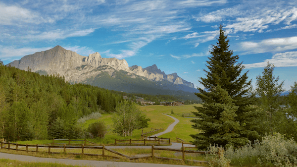
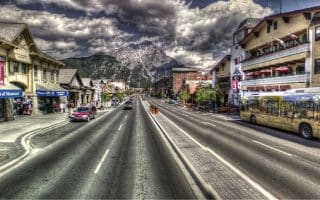
Canmore is a mecca for everything outdoorsy, from mountain biking, bouldering, peak bagging, skiing and of course running. It’s a 60 minute drive from Calgary, and also serves as a gateway to Banff National Park. In addition to some great trail running opportunities (see this post), there’s a fantastic, 70+ km network of paths. Our top recommendations
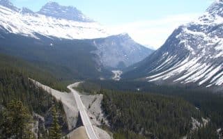
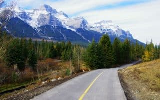
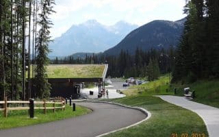
Legacy Trail. The signature running spot in the area. This paved multi-use path Runs for 23 km (17 miles), west to Banff, paralleling the Trans Canada Highway. The trail starts at the Alberta Visitors’ Center in Canmore. MAP
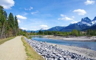
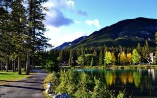
Bow River Paths. A great way to get a sense of the area. Plus, pretty and not too challenging! On the south side of the river, a mainly gravel path (Spur Line Trail) runs along the river, east from Bridge Ave. as far as the Timberline Lodge, ~7 km. MAP. On the north side, there’s ~2 km along the river (Higashikawa Friendship Trail) and you can do a 7km loop including the Canmore Recreation Center and Lions Park, on the Larch Island Trail. MAP
Three Sisters Pathway. A multi-use path that serves mainly the suburbs of Canmore. The path starts off Rundle Dr. just south of the bridge, and follows the Bow River southwest toward the village of Three Sisters Mountain. About 2/3 paved and 1/3 gravel, passing through meadows and woodland. East end is Three Sisters Mountain Village at Stewart Creek Landing pavilion. Numerous spur paths as well. 6.8 km (4.2 miles) one-way. MAP
Harvie Heights Trail. Not the most scenic, but a serviceable spot for running and an alternative to the Legacy Trail. This mainly paved multi-use path runs on the north side of the Trans-Canada, along the service roads: Palliser Trail and Harvie Heights Rd. 7.7 km (4.8 miles) one-way, some elevation gain. MAP
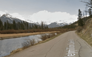
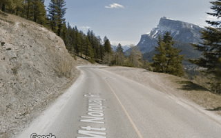
Rt. 742 to Whitemans Pond. This road heads south from the Canmore Nordic Center. We recommend the Rundle Mountain section, heading toward Grassi Lakes. The road quickly turns to gravel, going along the side of Rundle Mountain, and then above Grassi Lakes. The section along Whitemans Pond is especially pretty. From the Canmore Nordic Center, it’s 4 km to Grassi Lakes and 5 km to Whitemans Pond. AB-742 continues south for many km, but it’s more monotonous and not as pretty. Warning: can be VERY dusty in summer (i.e. bikers wear just masks) with lots of tourist traffic, and icy in winter. So run this one situationally.


Review or Comment on This Route/Share a Photo!
Share your feedback on this route and see that of other Great Runs users. Click on the image icon to upload a photo. And please let us know if there are notes or changes we should incorporate!