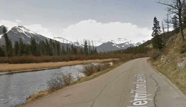
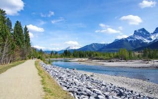
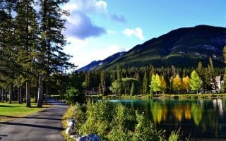
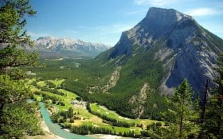
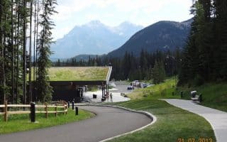
Vermilion Lakes Road is one of your best bets to get in a flat and scenic road run in Banff. The road runs parallel to the Trans Canada Highway, featuring wonderful views of the Vermilion Lakes and nearby mountains. The road also duplicates as a section of the Legacy Trail, a multi-use path that runs for 27 km south to Canmore. The ‘road’ section of Vermilion Lakes Rd. comes off the Mt. Norquay Rd./T-Can exit, and runs west for 4.4 km, where you can continue on the Legacy Trail (paved bike path) for another 1.5 km. In all, this can be a 12 km (7.5 mile) out and back.
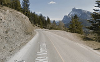
Add-Ons: Combine with other roads and paths in the area: the Fenland Trail, a 2 km wooded loop, just south on Norquay Rd., and the Bow River Trail, just south of there.
Vermilion Lakes Road is one of your best bets to get in a flat and scenic road run in Banff. The road runs parallel to the Trans Canada Highway, featuring wonderful views of the Vermilion Lakes and nearby mountains. The road also duplicates as a section of the Legacy Trail, a multi-use path that runs for 27 km south to Canmore. The ‘road’ section of Vermilion Lakes Rd. comes off the Mt. Norquay Rd./T-Can exit, and runs west for 4.4 km, where you can continue on the Legacy Trail (paved bike path) for another 1.5 km. In all, this can be a 12 km (7.5 mile) out and back.
Add-Ons: Combine with other roads and paths in the area: the Fenland Trail, a 2 km wooded loop, just south on Norquay Rd., and the Bow River Trail, just south of there.


Review or Comment on This Route/Share a Photo!
Share your feedback on this route and see that of other Great Runs users. Click on the image icon to upload a photo. And please let us know if there are notes or changes we should incorporate!