This ‘runseeing’ tour of Bridgetown and nearby waterfront packs many sights and a lot of variety into a 12 km route. Bridgetown, with a population of 110,00 is the capital of Barbados and its commercial and cultural center.
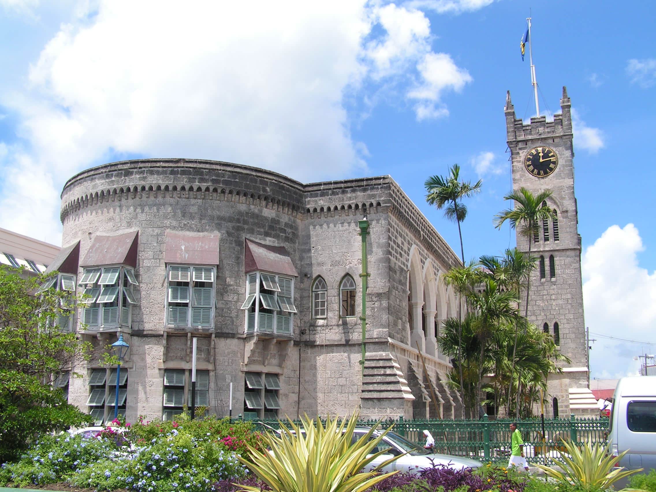
Start at the corner of High St. & Broad St., location of the Lord Nelson Statue. See the Exchange Museum, Parliament buildings. Take a quick jaunt across the Chamberlain Bridge, passing through Independence Arch, to the pier and Blackwoods Screw Dock. Come back and then head north along Wharf Rd., passing lots of shops and commercial establishments, to the Pelican Craft Center. Return to the center of Bridgetown using Cheapside Rd. and Chapel St., then LEFT on Milkside Rd. to see the Nidhe Israel Synagogue, one of the oldest synagogues in the western hemisphere. Take Magazine St. and then Spry St. to then take a jaunt along St. Michael’s Row to Queen’s Park. Take a RIGHT on John Beckles Dr., heading along the river back down to the waterfront, for ~1 km.
This next section is south along the famous Bay St. Esplanade for ~1.5 km, an area with a wide sidewalk, lots of vendors, and great waterfront views, and Brownes Beach–one of the most popular on Barbados. Go as far south as Chelsea St. or Aquatic Gap. Here, there are a couple of options: ~ 1 km out and back to the Needhams Point Lighthouse, and a 1.5 km loop around the Garrison Savannah, a historic horse race course that’s a grass field and generally open to the public for walking/running. The return 2 km north along Bay St. to Bridgetown and the Chamberlain Bridge.
Options: You could cut 2 km off the section out to Pelican Craft Center, or not do the Garrison Savannah. Also there are nice options to add in Bridgetown, creating your own route along some of its historic interior side streets.
This ‘runseeing’ tour of Bridgetown and nearby waterfront packs many sights and a lot of variety into a 12 km route. Bridgetown, with a population of 110,00 is the capital of Barbados and its commercial and cultural center.
Start at the corner of High St. & Broad St., location of the Lord Nelson Statue. See the Exchange Museum, Parliament buildings. Take a quick jaunt across the Chamberlain Bridge, passing through Independence Arch, to the pier and Blackwoods Screw Dock. Come back and then head north along Wharf Rd., passing lots of shops and commercial establishments, to the Pelican Craft Center. Return to the center of Bridgetown using Cheapside Rd. and Chapel St., then LEFT on Milkside Rd. to see the Nidhe Israel Synagogue, one of the oldest synagogues in the western hemisphere. Take Magazine St. and then Spry St. to then take a jaunt along St. Michael’s Row to Queen’s Park. Take a RIGHT on John Beckles Dr., heading along the river back down to the waterfront, for ~1 km.
This next section is south along the famous Bay St. Esplanade for ~1.5 km, an area with a wide sidewalk, lots of vendors, and great waterfront views, and Brownes Beach–one of the most popular on Barbados. Go as far south as Chelsea St. or Aquatic Gap. Here, there are a couple of options: ~ 1 km out and back to the Needhams Point Lighthouse, and a 1.5 km loop around the Garrison Savannah, a historic horse race course that’s a grass field and generally open to the public for walking/running. The return 2 km north along Bay St. to Bridgetown and the Chamberlain Bridge.
Options: You could cut 2 km off the section out to Pelican Craft Center, or not do the Garrison Savannah. Also there are nice options to add in Bridgetown, creating your own route along some of its historic interior side streets.
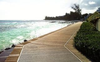
Pleasant, flat coastal running between Rockley Beach and the Needhams Point lighthouse. Combination road and boardwalk, with nice water views in parts. It's 5 km out and back. Add 1.5 mile around the Garrison Savannah.
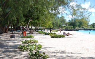
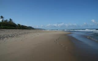
A nice off-road running opportunity near Holetown, the boardwalk goes for 2.5 km Sandy Lane Beach, north to Heron Bay. Some sections are boardwalk, others are on the beach. Great water views, lovely beaches, tropical vegetation.
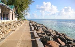
Some very nice waterfront running in the Speightstown area. Roads along the water, a jaunt around the Port St. Charles marina, and a quiet waterfront road out to Half Moon Fort.
Create your own route on the quiet roads in the St. Lucy area. A series of unnamed, fairly narrow roads between Highways 1B and 1C offer good rolling hill terrain. No shoulder/sidewalk but not trafficked.
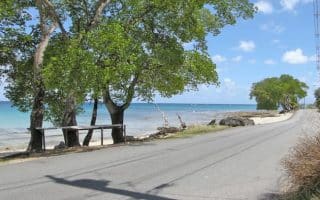
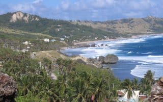
Good running on the coastal road on Barbados' more rugged east coast. Quietest section is ~1.5 km from Bathsheba Park heading north, but very runnable and pretty as far as Lakes Beach.
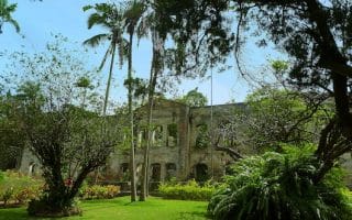
A challenging 12 km loop featuring interesting sights and great views, on generally quiet roads. Pass the Morgan Lewis Windmill, Cherry Tree Hill Reserve, St. Nicholas Abbey, and Farley Hill National Park. First 3 km is a steep climb!
The best bet for running on the southern coast is the 5 km out and back along a waterfront road from Miami Beach to just past the South Point Lighthouse. Quiet road, occasional water views. Decent side streets for additional mileage.
The best bets for beach running on Barbados are Rockley/Accra and Worthing Beach on the southwest coast. On the more rugged east coast, Bathsheba/Cattlewash/Lakes Beach, and then Walkers/Morgan Lewis Beach go for several km.
Share your feedback on this route and see that of other Great Runs users. Click on the image icon to upload a photo. And please let us know if there are notes or changes we should incorporate!

 This next section is south along the famous Bay St. Esplanade for ~1.5 km, an area with a wide sidewalk, lots of vendors, and great waterfront views, and Brownes Beach–one of the most popular on Barbados. Go as far south as Chelsea St. or Aquatic Gap. Here, there are a couple of options: ~ 1 km out and back to the Needhams Point Lighthouse, and a 1.5 km loop around the Garrison Savannah, a historic horse race course that’s a grass field and generally open to the public for walking/running. The return 2 km north along Bay St. to Bridgetown and the Chamberlain Bridge.
Review or Comment on This Route/Share a Photo!
Share your feedback on this route and see that of other Great Runs users. Click on the image icon to upload a photo. And please let us know if there are notes or changes we should incorporate!