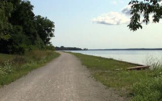
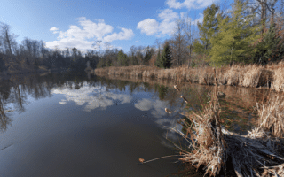
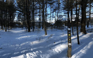
The North Simcoe Rail Trail represents another opportunity for a longer off-road run in Barrie. This multi-use trail follows the route of the former North Simcoe Railway, which was built in 1878 and primarily served for the lumber business on Georgian Bay. There are great views over the Minesing Wetlands and the Mayer’s Marsh. The trail runs for 24 km between Utopia and Elmvale, and overlaps with the long-distance Trans Canada trail in spots. Much of it is wooded.
The closest access point to Barrie is 11 km west of downtown, off Sunnidale Rd. in Utopia. Run north for as many km as you like! The gravel path is well waymarked and fairly flat. This trail guide (which says the trail is 31.7 km) has good information on points of interest along the way, and a good map with connector trails.


Review or Comment on This Route/Share a Photo!
Share your feedback on this route and see that of other Great Runs users. Click on the image icon to upload a photo. And please let us know if there are notes or changes we should incorporate!