Orillia is a popular destination, especially in summer, for its waterfront activities on Lake Couchiching. The are two particularly good running options here: a lakefront path and a section of the Trans Canada Trail headed north or south.
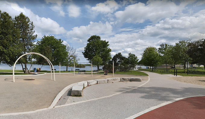
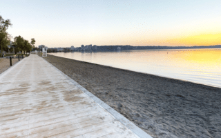
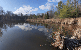
Waterfront Path: This is our favorite run in Orillia. A multi-use trail runs all the way from Couchiching Beach Park to Rama, for a total distance of 10.5 km one-way. The best waterfront section is the first 6.5 km to the swing bridge over the narrows in Atherly. Part of this trail is called the Millennium Trail. About 2/3 of this stretch is along the water, with nice views of the port of Orillia and the lake. Past Atherly, the trail (called the Rama Trail) is mainly gravel and inland for 4 km to Mara Rama Boundary Road.
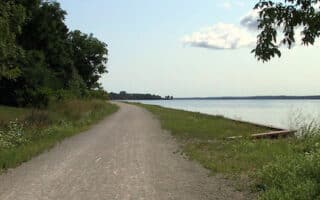
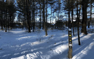
Trans Canada Trail North: A section of the Trans Canada trail, also called the Uhthoff Trail, runs north for many km toward Georgian Bay. We’ve mapped 24 km to Coldwater. This is a popular long-distance multi-use path for walking/running & cycling. It’s fairly wide with a good gravel surface. Some sections are wooded, others pass by the area’s farms. In Orillia, start at the Lightfoot trailhead near Couchiching Beach Park. It’s fairly flat.
Lake Country ORO Medonte Rail Trail. You can also access the Orillia terminus of the Lake Country ORO Medonte Rail Trail that goes for 30 km south to Barrie. Access is at West St., near the Orillia Recreation Centre. ROUTE
Orillia is a popular destination, especially in summer, for its waterfront activities on Lake Couchiching. The are two particularly good running options here: a lakefront path and a section of the Trans Canada Trail headed north or south.
Waterfront Path: This is our favorite run in Orillia. A multi-use trail runs all the way from Couchiching Beach Park to Rama, for a total distance of 10.5 km one-way. The best waterfront section is the first 6.5 km to the swing bridge over the narrows in Atherly. Part of this trail is called the Millennium Trail. About 2/3 of this stretch is along the water, with nice views of the port of Orillia and the lake. Past Atherly, the trail (called the Rama Trail) is mainly gravel and inland for 4 km to Mara Rama Boundary Road.
Trans Canada Trail North: A section of the Trans Canada trail, also called the Uhthoff Trail, runs north for many km toward Georgian Bay. We’ve mapped 24 km to Coldwater. This is a popular long-distance multi-use path for walking/running & cycling. It’s fairly wide with a good gravel surface. Some sections are wooded, others pass by the area’s farms. In Orillia, start at the Lightfoot trailhead near Couchiching Beach Park. It’s fairly flat.
Lake Country ORO Medonte Rail Trail. You can also access the Orillia terminus of the Lake Country ORO Medonte Rail Trail that goes for 30 km south to Barrie. Access is at West St., near the Orillia Recreation Centre. ROUTE


Review or Comment on This Route/Share a Photo!
Share your feedback on this route and see that of other Great Runs users. Click on the image icon to upload a photo. And please let us know if there are notes or changes we should incorporate!