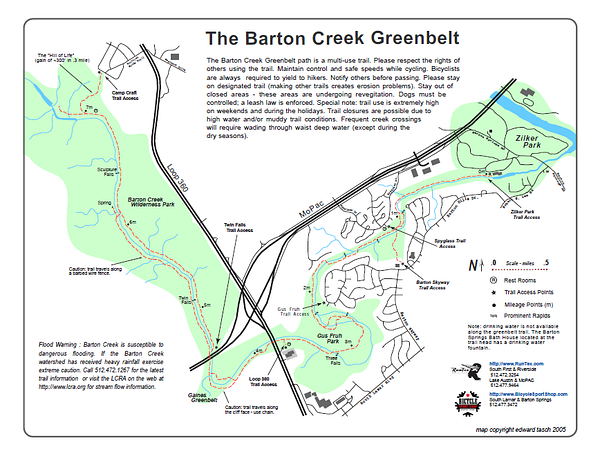
The Barton Creek Greenbelt extends 7.5 miles one way from Ziker Memorial Park, near the southeastern terminus of the Lady Bird Lake Trail. This greenbelt has plenty of variety. At the start, it’s more parkland along the creek. But along the way there are numerous offshoots for running/hiking, including some more rugged trails than lead to cliffs, rock climbing, and some swimming holes. The last section is the famous “Hill of Life”, which is a 300m climb in 0.3 miles. This is fairly technical, challenging trail running in parts. We’ve mapped out the entire 7.5 mile trail one-way. A good place to turn around is at the 4-mile mark at Rt. 360, where the trail gets more rugged. Apparently the Taco Deli on Spyglass is the place to fuel up.
[/vc_column_text][/vc_column][/vc_row]
Hello Great Runs Users! A few quick notes:
ROUTE MAPS are now on the route page! Scroll down to below the route description to see the route map. More details on new layout HERE
Sign up for our free newsletter for the latest additions to GR, fun compilations, running tips, & more!
If you prefer an ad-free experience, we have modest monthly & annual subscription options. SIGN UP
If you’ve signed up for ad-free, you need to be signed into your account.