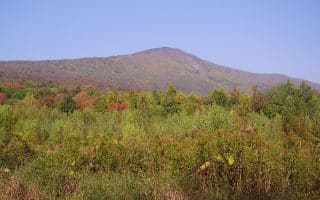
Mount Greylock is the highest point in Massachusetts at 3,491 feet, with views stretching across the Berkshire hills to New York, Connecticut, Vermont, and New Hampshire beyond. The Mount Greylock State Reservation is a popular hiking area, with numerous trails winding to the summit. A couple of running options in this area:
Greylock Scenic Byway. Choose a section of this 17-mile road, which runs between Lanesborough and North Adams. Also known as Rockwell Rd., the byway goes through Greylock State Reservation, and up to the summit of Mt. Greylock. This is steep and challenging. You can look at the elevation profile to choose a gentler section of the road, or have a partner drop you off and run down! The road has a shoulder, but can be windy, so keep an eye out for cars. Note: Road closed November-May, but still walking/running permitted!
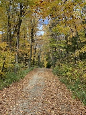
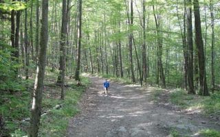
Sperry Rd. Author photo
Run to the Summit. If you just want to do the summit section of Mt. Greylock, park at the campground lot, and run on Rockwell Rd. to the summit. It’s 3 miles one-way, elevation gain of 1,058 feet, average grade of 6.5%. (Note: closed to cars Novembe-May).
Sperry Road. For a less challenging run, the best spot in Greylock State Reservation is Sperry Rd. It comes off Rockwell Rd. and leads to a campground. Run as far as the Haley Farm Trailhead, 3.6 miles. You can also start the run at the Haley Farm Trailhead, off Hopper Rd. (which itself is nice for running!). Sperry Rd. is especially gorgeous in autumn. A highlight of the route is Stony Ledge, known for its fantastic views!
Mount Greylock is the highest point in Massachusetts at 3,491 feet, with views stretching across the Berkshire hills to New York, Connecticut, Vermont, and New Hampshire beyond. The Mount Greylock State Reservation is a popular hiking area, with numerous trails winding to the summit. A couple of running options in this area:
Greylock Scenic Byway. Choose a section of this 17-mile road, which runs between Lanesborough and North Adams. Also known as Rockwell Rd., the byway goes through Greylock State Reservation, and up to the summit of Mt. Greylock. This is steep and challenging. You can look at the elevation profile to choose a gentler section of the road, or have a partner drop you off and run down! The road has a shoulder, but can be windy, so keep an eye out for cars. Note: Road closed November-May, but still walking/running permitted!
Sperry Rd. Author photo
Run to the Summit. If you just want to do the summit section of Mt. Greylock, park at the campground lot, and run on Rockwell Rd. to the summit. It’s 3 miles one-way, elevation gain of 1,058 feet, average grade of 6.5%. (Note: closed to cars Novembe-May).
Sperry Road. For a less challenging run, the best spot in Greylock State Reservation is Sperry Rd. It comes off Rockwell Rd. and leads to a campground. Run as far as the Haley Farm Trailhead, 3.6 miles. You can also start the run at the Haley Farm Trailhead, off Hopper Rd. (which itself is nice for running!). Sperry Rd. is especially gorgeous in autumn. A highlight of the route is Stony Ledge, known for its fantastic views!
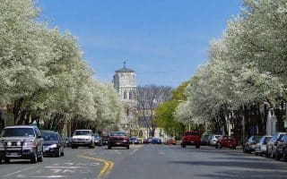
The town center of Great Barrington is classic New England. Enjoy a nearly 5 mile loop through downtown, along the River Walk, and some lovely roads up to Bard College and around Lake Mansfield.
Enjoy a series of lovely paths on the grounds of this lovely museum, which wind through apple orchards down to the Housatonic River. Outdoors there are impressive gardens and larger than life sculptures. Nearby roads are good for running.
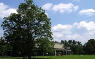
A run combining the fabulous grounds at Tanglewood with the trails of Kennedy Memorial Park, 2.5 miles away, and scenic connector roads. A great mix for fall. Hilly.
This is a gentler trail running opportunity, in the heart of Lenox. Kennedy Park maintains smooth, runnable trails There is a nice, ~4.5 mile loop starting at the Arcadian Shop off Route 20. Options to add more on the trails -- bring a map!
Not only does this rural route carry over a railroad bridge, it covers a stretch of Sleepy Hollow Road. Toss in some dirt back roads and a nice hilly vista and it doesn’t get more Berkshires than that!
This hilltop winery seems to offer everything: from apple picking to hayrides, to live music, to full moon hikes. Little do most know that the farm’s extensive network of cross country skiing trails are also open to runners and mountain bikers.
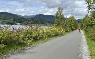
Great option for a longer, flat, off-road run in the Berkshires. This paved Rail Trail spans 13.6 miles between Adams and Lanesborough. Views of the Hoosac Mountains, Hoosic River, Cheshire Reservoir, and the wetlands which wind between them.
A hilly but quiet and low traffic route through Lanesborough, starting where Greylock Rd. and North Main St. splits is mostly dirt, so the track is easy on the joints and super-scenic.
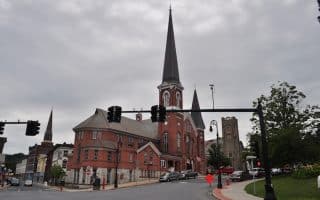
We've put together a 4 mile loop around this northern Berkshires city. Home of MASS MoCa, North Adams is a center of art, culture, good restaurants, and historic buildings. Murals, developing River Walk, and Western Heritage Gateway State Park.
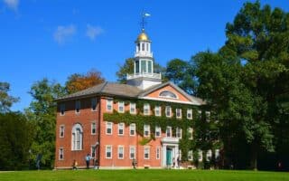
A popular destination in the Berkshires, known for the bucolic campus of Williams College, the Clark Art Institute, and the Williamstown Theater Festival. We've put together a 5-mile outline route, with some options for longer...and hillier!
Share your feedback on this route and see that of other Great Runs users. Click on the image icon to upload a photo. And please let us know if there are notes or changes we should incorporate!




Review or Comment on This Route/Share a Photo!
Share your feedback on this route and see that of other Great Runs users. Click on the image icon to upload a photo. And please let us know if there are notes or changes we should incorporate!