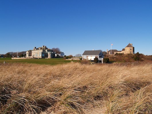
Westport is a very pretty coastal town near the Rhode Island border, with roads winding along the beach, the Westport River, pastoral farms, and tony golf courses. We’ve designed two great running loops in Westport: one along the roads paralleling Horseneck Beach and out to Gooseberry Island, and another in the coastal hamlet of Acoaxet.
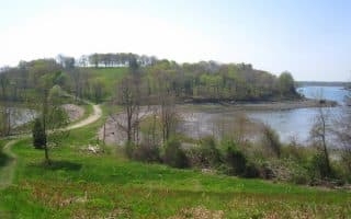
Gooseberry Island
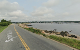
Horseneck Beach/Gooseberry Island Loop: This is a 4.3 mile run with great water views the whole way and very little traffic! The route is a straightforward 1 mile along East Beach Rd., and then a 2 mile out and back on Gooseberry Island. For more length, combine with a run on Horseneck Beach or on West Beach Rd., paralleling the beach.
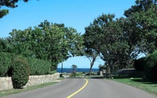
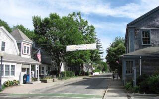
Acoaxet Loop. This is a straightforward 4-mile loop on some very pretty roads, with a combination of coastal views, farmland, a golf course, and nice homes. A good starting spot is the Harbor Inn on Acoaxet Rd. The first 3/4 mile is a jaunt out to The Knubble (nice views), then doubling back, onto Atlantic Ave. with nice coastal views. At the end, turn RIGHT, heading north on Howland Rd. for ~1 mile. Just past the chapel, RIGHT on Cross St. for 0.6 miles, then RIGHT on River Rd., heading back toward the water to the Harbor Inn. Longer option: head north on River Rd. No shoulder, but pretty and runnable.
Westport is a very pretty coastal town near the Rhode Island border, with roads winding along the beach, the Westport River, pastoral farms, and tony golf courses. We’ve designed two great running loops in Westport: one along the roads paralleling Horseneck Beach and out to Gooseberry Island, and another in the coastal hamlet of Acoaxet.
Gooseberry Island
Horseneck Beach/Gooseberry Island Loop: This is a 4.3 mile run with great water views the whole way and very little traffic! The route is a straightforward 1 mile along East Beach Rd., and then a 2 mile out and back on Gooseberry Island. For more length, combine with a run on Horseneck Beach or on West Beach Rd., paralleling the beach.
Acoaxet Loop. This is a straightforward 4-mile loop on some very pretty roads, with a combination of coastal views, farmland, a golf course, and nice homes. A good starting spot is the Harbor Inn on Acoaxet Rd. The first 3/4 mile is a jaunt out to The Knubble (nice views), then doubling back, onto Atlantic Ave. with nice coastal views. At the end, turn RIGHT, heading north on Howland Rd. for ~1 mile. Just past the chapel, RIGHT on Cross St. for 0.6 miles, then RIGHT on River Rd., heading back toward the water to the Harbor Inn. Longer option: head north on River Rd. No shoulder, but pretty and runnable.
Scroll Down For Route Maps
Essentials
Gooseberry Island route: 4.3 miles; Acoaxnet Loop: 4 miles
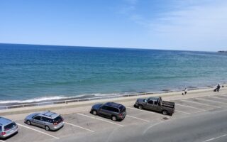
The three best beaches for running on Boston's south shore are Nantasket Beach, Duxbury Beach, and Horseneck Beach. All are long, fairly flat, and feature compact sand — especially at low tide.
A 2 mile boardwalk along Quincy Bay, with great water and Boston skyline views. Quincy is the closest south shore town to Boston. For a longer run, enjoy 1.5 miles on Squantum, also along the water and marshes.
7,000 acres of preserved land, incorporating 5 towns. 125 miles of trails — some of them great for running. Look for the wider, flat trails on the map. For a real challenge, 1-mile Summit Rd. is closed to cars and has 350 feet of elevation gain averaging 10% grade.
Overlooking Hingham Harbor just south of Boston, Worlds End offers several miles of roads and trails, flanked by specimen trees, with great views to the water and the Boston skyline. Enjoy 3+ miles of carriage road type trails in this Olmsted-designed park.
A scenic run in the area of Nantasket Beach that includes several miles of waterside running, combining the boardwalk along Nantasket Beach & waterfront roads on the west side. 3.5 mile beach also great for running.
The Hull loop is among our favorite runs on Boston's south shore. Waterfront roads from Allerton to Pemberton Point, with great views of Massachusetts Bay, Hull Bay, Boston Harbor Islands, & the Boston skyline!
The 3 miles along Jerusalem Rd. & Atlantic Ave. is one of the longest waterside stretches of road along Boston's south shore. Fantastic water views and spectacular homes in this tony coastal town.
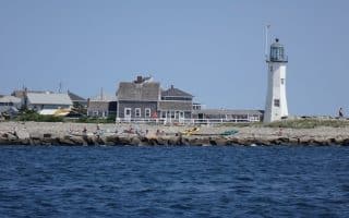
Scenic waterside running in this coastal town located between Boston and Plymouth. Great ocean views, pretty homes, Scituate Lighthouse, Museum Beach, Scituate Harbor and Marina. Can add w/First & Second Cliff.
A 'Runseeing' Tour of one of the country's first settlements, landing site of the Mayflower, and location of the First Thanksgiving. The 3.2 mile run includes the most important sites and waterside spots. Longer option adds up to 3 off-road miles.
One of the best off-road running opportunities south of Boston. Create your own route among the many miles of trails, all winding through woods of pitch pine and oak. Take a post-run dip in one of the unique kettle ponds!
Several terrific running routes in these historic cities, including a gorgeous waterfront run, a 'runseeing' tour of New Bedford's center & Captains Homes, and a scenic multi-use trail between Fairhaven and Mattapoisett.
A scenic road run in South Dartmouth, with rolling farmland, nice homes, and some views to Apponagansett Bay. A highlight Gulf Rd. over the Bay. We've mapped a 7.5 mile loop, with options for longer and shorter.
A scenic run through a classic New England small coastal town. Lovely homes, some water views, and the Tabor Academy campus, an upscale prep school which also has a running track.
Share your feedback on this route and see that of other Great Runs users. Click on the image icon to upload a photo. And please let us know if there are notes or changes we should incorporate!
Subscribe
0 Comments
Oldest
Newest
Inline Feedbacks
View all comments
Essentials
Gooseberry Island route: 4.3 miles; Acoaxnet Loop: 4 miles


Review or Comment on This Route/Share a Photo!
Share your feedback on this route and see that of other Great Runs users. Click on the image icon to upload a photo. And please let us know if there are notes or changes we should incorporate!