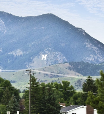
This is a fun and scenic but super-challenging hike/run to a unique spot — a giant ‘M’ sign representing Montana State University. The ‘Trail to M’ starts off Bridger Canyon Rd., about 4 miles north of downtown. It is a 1.8 mile loop, climbing 800 feet in over 1 mile, with 10-11% grades. The terrain is open and scenic. The descent is short and super steep — use caution! For more, Bridger Canyon Rd. is scenic, but the road has no shoulder, so use caution.
Runners can access the trailhead from the city on the Bozeman to Bridger Mountains Trail. It’s a paved 2 mile segment of the “Main Street to Mountains” System, beginning from the Story Mill Spur.
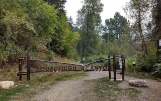
There are other trails in this area — but these are definitely for trail running and can be quite hilly and challenging. From the College ‘M’ Trail, the Bridger Foothills Trail continues north toward Baldy Mountain. Just across Bridger Canyon Rd., on the south side, is the Drinking Horse Hill Trail.
This is a fun and scenic but super-challenging hike/run to a unique spot — a giant ‘M’ sign representing Montana State University. The ‘Trail to M’ starts off Bridger Canyon Rd., about 4 miles north of downtown. It is a 1.8 mile loop, climbing 800 feet in over 1 mile, with 10-11% grades. The terrain is open and scenic. The descent is short and super steep — use caution! For more, Bridger Canyon Rd. is scenic, but the road has no shoulder, so use caution.
Runners can access the trailhead from the city on the Bozeman to Bridger Mountains Trail. It’s a paved 2 mile segment of the “Main Street to Mountains” System, beginning from the Story Mill Spur.
There are other trails in this area — but these are definitely for trail running and can be quite hilly and challenging. From the College ‘M’ Trail, the Bridger Foothills Trail continues north toward Baldy Mountain. Just across Bridger Canyon Rd., on the south side, is the Drinking Horse Hill Trail.

Review or Comment on This Route/Share a Photo!
Share your feedback on this route and see that of other Great Runs users. Click on the image icon to upload a photo. And please let us know if there are notes or changes we should incorporate!