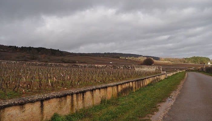
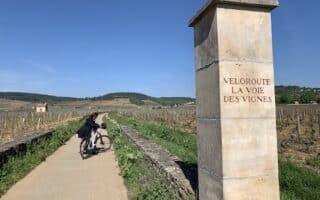
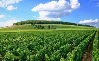
Puligny-Montrachet and Chassagne-Montrachet together make up a famous wine region. There are some very pretty and quiet roads here winding through the vineyards. We’ve mapped out lovely 8 km scenic loop, rolling hills, some on unnamed roads. You can also use our route as a general guideline — there are numerous small, pretty, and relatively untrafficked roads in this area.
Find the sign marked “Circuit No. 23” opposite the hotel in the corner of the square, then take Rue du Pot de Fer west. Turn LEFT, leaving the village and running through the vineyards to the south. Stay on the paved road, ignore the turnoff on the right, and continue towards the quarries of Chassagne-Montrachet. At the circular building, turn RIGHT, then after 20 meters turn RIGHT again between the stone walls. At the next junction, turn left on a narrow paved road. Then, turn LEFT onto the D113 a for 10 meters before turning RIGHT uphill. Arrive at the “Chevalier Montrachet”, turn RIGHT, then LEFT onto the grassy path along the wall. Where the wall ends, cross the wide dirt road and continue straight on the path. The path leads to the top of Montrachet. Turn RIGHT at the edge of the thicket and along the vineyards. Turn RIGHT at the next road, then turn LEFT on an uphill path. At the road posted P35, turn RIGHT on the paved road and through the vineyards past the “Chapelle Saint Charles.” Turn RIGHT again to pass through Blagny, then follow the road LEFT then RIGHT through the village. At the tennis courts, turn LEFT along the wall and then turn RIGHT at the water department (Service des Eaux). Turn LEFT towards the pine grove, then reach a tarmac road, turning LEFT, then left again. At the Meursault-Charmes junction, turn right. Ignore all side paths, cross straight at the stop sign, then turn RIGHT at the next intersection. At the fork, go straight on the orange-marked bridle way back to Rue du But in Puligny-Montrachet.
Review or Comment on This Route/Share a Photo!
Share your feedback on this route and see that of other Great Runs users. Click on the image icon to upload a photo. And please let us know if there are notes or changes we should incorporate!