A quick overview of our extensive Cape running guide of 20+ routes: Our top 5 Cape runs; Best routes by theme (beach, along the water, trails, architecture...); and sorted by geography (Upper-Mid-Lower-Outer Cape).
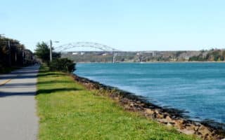
Wonderful, paved trail running for 7 miles along the Cape Cod Canal between the Bourne and Sagamore bridges. Great water and bridge views the whole way. Can run on the north or south sides. Markers every 1/2 mile.
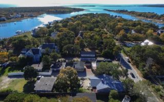
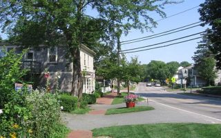
A great 3.8 mile tour incorporating quaint Main St., historic residential area, boardwalk to a beach, and waterside roads with great views.
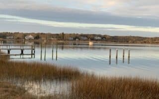
A nice option in the Mashpee area. Run along Red Brook Road and down across a causeway. The island is a mix of old cottages and newer lush homes. This finger of land has good water views on either side as you get toward the tip.
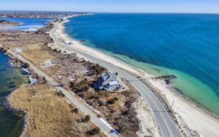
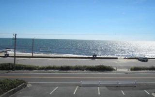
Fantastic waterside running, with views to Vineyard Sound. There are two ~3 mile one-way sections: Surf Drive; and Grand Ave. & Menauhant Ave. from Falmouth Heights Beach to East Falmouth. A 2 mile 'inland' section separates these two areas.
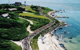
Famous road race and one of the most scenic runs on the Cape. 7-mile one way course between Woods Hole and Falmouth Heights Beach, with with ocean views for more than half the route. There are mile markers along the route!
A 'highlights of Osterville' route, along pretty roads with some lovely homes and occasional ocean views. One of the nicest stretches is along East Bay Rd.
A pleasant run starting along cute Barnstable Village Main St. There are two loops: a 2.75 mile more wooded loop, and a 2 mile loop with water and farmland marsh views.
Park and trail system, with vast dunes, vernal pools, maritime forests, and a public beach. The area is great for walking, and running is possible though surfaces vary and it can be challenging. A fun route is to combine the beach and Marsh Trail.
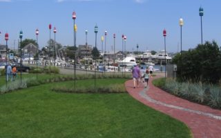
One of the best waterside runs in the mid-Cape. The main feature is a run down to Kalmus beach, and a run around the Hyannis Inner Harbor. The area is busy and bustling in mid-summer.
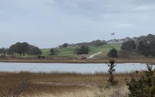
A great little loop of this affluent summer community, featuring gorgeous ocean views, spectacular homes, and the Kennedy Compound. Can be done standalone or combined with our Hyannis route.
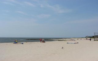
Classic Cape Cod run: Sandy beach roads along weathered beach cottages and seafood restaurants, some areas with fancier homes, shaded cottage-y side streets, and some beach side running. We've put together two great options.
Paved bicycle trail that runs 22 miles from South Dennis to Wellfleet. The CCRT passes by many local points of interest &several areas with lakes suitable for swimming /picnicking, including Nickerson State Park in Brewster. Includes 5-mile spur to Chatham.
Part of the 'Marathon Sports' group run, along trails & paths from Station Ave. Also, the Yarmouth running scene is about to get better, with the extension of the Cape Cod Rail Trail from South Dennis to Yarmouth.
A pleasant alternative to the bike path, the highlight of this loop is Red River Beach, using Uncle Venies Rd. Nice views, and a nearly 1 mile section along the beach or beach parking lot road. Good opportunities to vary the run.
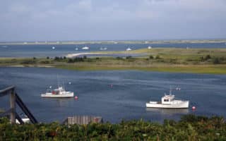
Chatham is one of the prettiest towns on the Cape. This is a grand 7.5 mile tour, which includes a run along Shore Dr., a section along Oyster Pond, and a jaunt out to Morris Island and the Monomoy Wildlife Refuge. Good options to vary & shorten.
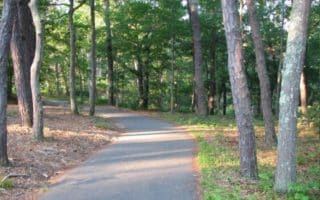
Like running in a pine forest of North Carolina. 8 miles of paved, hilly bike trails make for a great off-road option in the mid-Cape. Cool off with a swim in one of the 8 kettle (glacial) ponds.
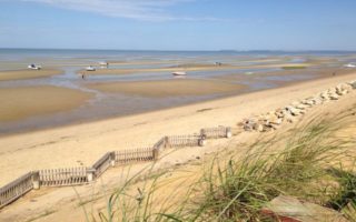
The best beach running on the Cape tends to be on the Bay side. A favorite is in the Brewster area, between Breakwater Beach in the north and Boat Meadow Landing in the south. In good conditions, this is beach running heaven.
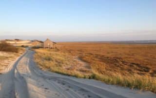
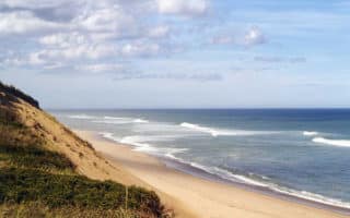
The signature ocean side beaches on Cape Cod are along Cape Code National Seashore, which stretches from Eastham to Provincetown. Running on these beaches is situational - can be great, or sloped with softer sand.
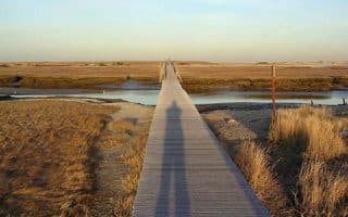
Some great running options around the Salt Pond Visitor Center in Eastham: 1.3 mile Nauset Marsh Trail (sandy); 1.5 mile Nauset Trail down to Coast Guard Beach. A 'full tour' 6.5 miles, including Ocean View Dr. to Nauset Light Beach & Nauset Lighthouse.
Wellfleet is one of the prettiest towns on the Cape. A lovely, short loop incorporates Main St. and heads down to the Harbor. A longer run is to head along Chequessett Neck Rd. out to the Great Island parking lot.
Nice open run in Wellfleet, atop bluffs, with ocean views along part of the way. The whole section is 3.3 miles one way, or a nice there and back is the 1.8 miles to the Beachcomber. Can be combined with one of the inland roads.
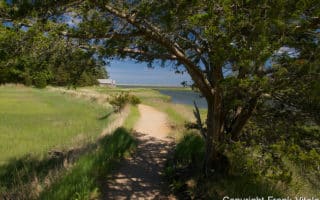
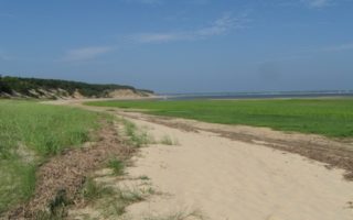
One of the most wonderful places to run on Cape Cod. The beach at Great Island is fantastic for running at low tides. The area is a popular walking/hiking trail, combining pine forest, mud flats, marshes, and a beautiful beach. Can be challenging due to soft sand.
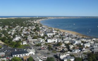
Seaside town at the northern tip of Cape Cod with a bustling commercial street in summer. Good running options are along Commercial St., on the beach (tide dependent), and a 7 mile loop including part of the Province Lands trails. Great at sunset!
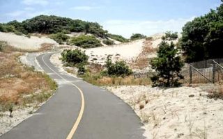
One of most spectacular and varied runs on the Cape. The 5.5 mile paved bike trail undulates through pine forests, sandy dunes, and low-lying cranberry bogs. It's a unique experience to run on a trail through sandy dunes.
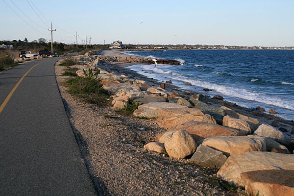
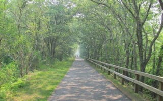
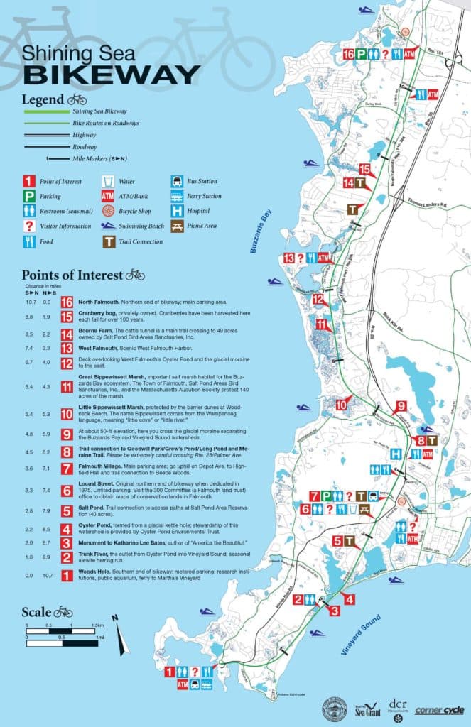 The Shining Sea Bikeway is a 10.7 mile paved path between Woods Hole and North Falmouth, The trail passes by glacial ponds, farms, cranberry bogs, and wooded reservations. The most spectacular section is the two miles along the water at the Woods Hole end of the trail. There are connections to the Ferry terminal, Palmer Rd. parking lot, and other trails and reservations. We’ve attached a route map and a map with key distances and trail information.

Review or Comment on This Route/Share a Photo!
Share your feedback on this route and see that of other Great Runs users. Click on the image icon to upload a photo. And please let us know if there are notes or changes we should incorporate!