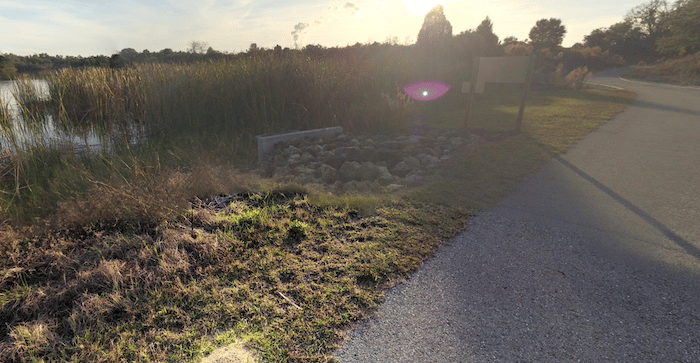
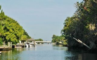
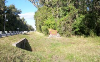
This is a pleasant loop around Inglis Island, part of the Cross Florida Greenway trail. Located 15 miles north of Crystal River. Inglis Island sits in the center of three bodies of water — the Withlacoochee River, the never completed Cross Florida Barge Canal and Lake Rousseau, with a dam at the southern end. This route was inspired by ************@***il.com” data-hovercard-owner-id=”154″>Aurélie Vilmer.
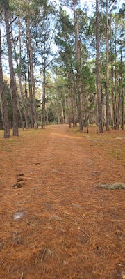
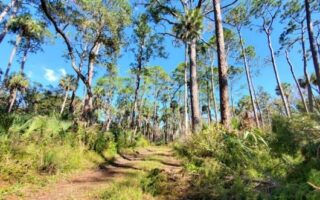
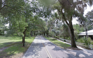
The trails are flat and easy, part paved and part dirt. The are views of Lake Rousseau, and also some nice woods and marshlands. Starting at the southern end at Lake Rousseau Dam & Recreational Area, a loop of the island is ~6 miles. There are additional interior trails for those wanting a longer run.
Aurélie Vilmer
This is a pleasant loop around Inglis Island, part of the Cross Florida Greenway trail. Located 15 miles north of Crystal River. Inglis Island sits in the center of three bodies of water — the Withlacoochee River, the never completed Cross Florida Barge Canal and Lake Rousseau, with a dam at the southern end. This route was inspired by ************@***il.com” data-hovercard-owner-id=”154″>Aurélie Vilmer.
The trails are flat and easy, part paved and part dirt. The are views of Lake Rousseau, and also some nice woods and marshlands. Starting at the southern end at Lake Rousseau Dam & Recreational Area, a loop of the island is ~6 miles. There are additional interior trails for those wanting a longer run.
Scroll Down For Route Maps
Essentials
5.7 mile (9.2 km) loop of Island
116 feet (35m)
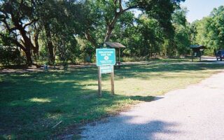
Lake Rousseau Dam & Recreational Area, off W Riverwood Rd.
A pleasant road run in the Crystal River area, featuring nice views of Kings Bay and some small parks and preserves. In winter, you might spot a manatee! Includes Three Sisters Springs, Hunter Springs Park, and Kings Bay Park.
Run longest unpaved loop in Citrus County! The Seven Mile Loop Trail is the Preserve's signature route. A wide, flat, well-maintained trail through woods, marsh flats, and crossing three tidal creeks. There's also a 2.1 mile Eco-Trail.
Great opportunity for an off-road run on one the longest rail trails in Florida. 20+ miles passes through Citrus County. Nice combination of ranches/farms, woods, small towns, parks & preserves. Some good side options to add on.
Run beneath towering oaks on the quiet streets of Floral City. A very pretty canopy. Combine with the Withlacoochee State Trail, a paved multi-use path which heads for many miles north or south of Floral City.
Some of the best trail running options in the Citrus County area. Massive area, with several tracts, each with its own unique features and trail options. Citrus Tract, Holder Mine, Tillis Hill are the 'heart' of the forest.
Share your feedback on this route and see that of other Great Runs users. Click on the image icon to upload a photo. And please let us know if there are notes or changes we should incorporate!
Subscribe
0 Comments
Oldest
Newest
Inline Feedbacks
View all comments
Essentials
5.7 mile (9.2 km) loop of Island
116 feet (35m)
Lake Rousseau Dam & Recreational Area, off W Riverwood Rd.

Review or Comment on This Route/Share a Photo!
Share your feedback on this route and see that of other Great Runs users. Click on the image icon to upload a photo. And please let us know if there are notes or changes we should incorporate!