For those looking for an alternative to the Cliffs of Moher and other area trails, there are some scenic roads for running as well. We should first point out that the main road R477, although scenic, does not have a shoulder. It’s not hugely trafficked, but we can’t really recommend running it from a safety perspective. However, some of the side roads are scenic and safer for running. These are country roads passing by farms, and are generally quite narrow (one lane!) — but there’s very little traffic. Some recommendations:
Between the Aloha Surf School and and Craggagh in the Fanore area. Nice side road paralleling the R477. ~2.5 km each way.
‘View of the Burren’ Area. Just north of Gortacarnaun, a side road leads from the R477 toward the View of the Burren rental. Nice network of small country roads through the Burren in this area. Can be combined with a section of The Burren path.
Between Fanore and Black Head. Just off the R477 at the Fanore Lodge, there are very scenic side roads headed west toward the water, and east toward the Caher Bridge Garden and Fermoyle.
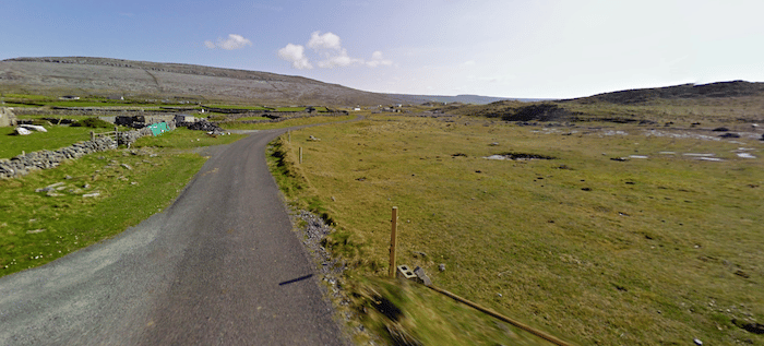
Area Around Black Head. If you were to try to brave a section of the R477, the area around Black Head Lighthouse is drop-dead gorgeous. The road is narrow, but incredibly scenic! The section of the Burren trail around here is more rugged, owing to the rocky landscape.
R477 Near Black Head. Google Street View
For those looking for an alternative to the Cliffs of Moher and other area trails, there are some scenic roads for running as well. We should first point out that the main road R477, although scenic, does not have a shoulder. It’s not hugely trafficked, but we can’t really recommend running it from a safety perspective. However, some of the side roads are scenic and safer for running. These are country roads passing by farms, and are generally quite narrow (one lane!) — but there’s very little traffic. Some recommendations:
Between the Aloha Surf School and and Craggagh in the Fanore area. Nice side road paralleling the R477. ~2.5 km each way.
‘View of the Burren’ Area. Just north of Gortacarnaun, a side road leads from the R477 toward the View of the Burren rental. Nice network of small country roads through the Burren in this area. Can be combined with a section of The Burren path.
Between Fanore and Black Head. Just off the R477 at the Fanore Lodge, there are very scenic side roads headed west toward the water, and east toward the Caher Bridge Garden and Fermoyle.
Area Around Black Head. If you were to try to brave a section of the R477, the area around Black Head Lighthouse is drop-dead gorgeous. The road is narrow, but incredibly scenic! The section of the Burren trail around here is more rugged, owing to the rocky landscape.
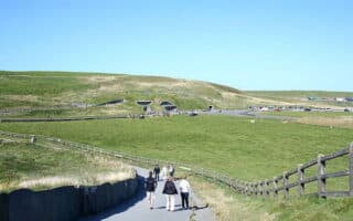
Running the Cliffs of Moher makes for a memorable running experience. A very runnable path runs atop the cliff for nearly 7 miles, with spectacular vistas over the Atlantic Ocean and the Aran Islands.
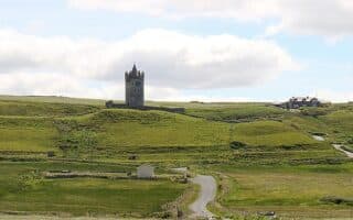
A nice running alternative in the Cliffs of Moher area. From Doolin, choose a section of the Burren Way -- either a coastal section or an inland path passing through numerous farms and small settlements.
Share your feedback on this route and see that of other Great Runs users. Click on the image icon to upload a photo. And please let us know if there are notes or changes we should incorporate!

Review or Comment on This Route/Share a Photo!
Share your feedback on this route and see that of other Great Runs users. Click on the image icon to upload a photo. And please let us know if there are notes or changes we should incorporate!