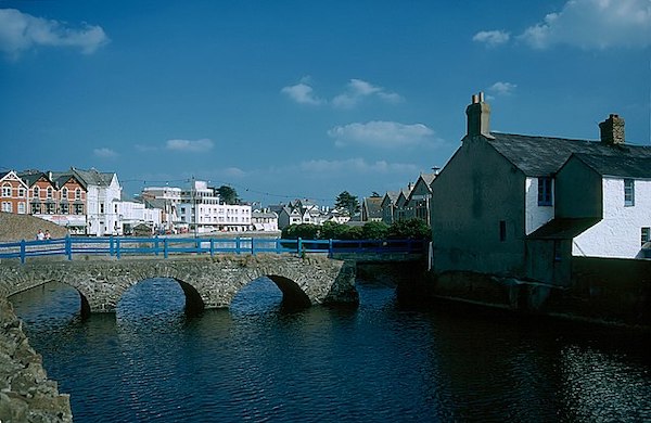
The seaside town of Bude lies toward the northeast corner of Cornwall, at the mouth of the River Neet. One can put together some nice running in Bude, combining an easy section of S W Coast Path north to Northcott Mouth Beach and south on a cycle path along the Bude Canal. Together, the two routes are a 10k!
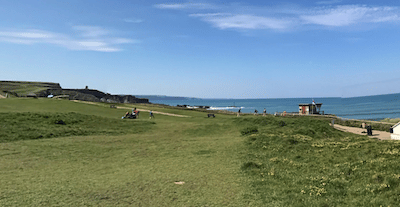
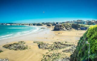
Path to Northcott Mouth Beach. Google Street View
Start in central Bude near the tourist information center. Head north through the car park and join the S W Coast Path. This is a scenic, easy section of path above Bude Bay, with nice views. 1.7 miles, rolling hills, ending at Northcott Mouth Beach.
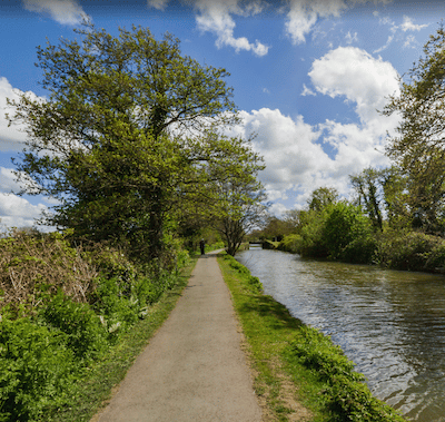
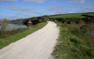
Bude Canal Path. Google Street View
The next section is south on the gravel multi-use trail along the Bude Canal. Follow The Strand for 0.4 miles, and then join the path for 0.8 miles to County Rd. Turn LEFT on County Rd., then use then LEFT along another multi-use path back to Bude. This is a 2.7 mile loop.
Add-Ons: More sections of S W Coast Path, varying levels of difficulty.
The seaside town of Bude lies toward the northeast corner of Cornwall, at the mouth of the River Neet. One can put together some nice running in Bude, combining an easy section of S W Coast Path north to Northcott Mouth Beach and south on a cycle path along the Bude Canal. Together, the two routes are a 10k!
Path to Northcott Mouth Beach. Google Street View
Start in central Bude near the tourist information center. Head north through the car park and join the S W Coast Path. This is a scenic, easy section of path above Bude Bay, with nice views. 1.7 miles, rolling hills, ending at Northcott Mouth Beach.
Bude Canal Path. Google Street View
The next section is south on the gravel multi-use trail along the Bude Canal. Follow The Strand for 0.4 miles, and then join the path for 0.8 miles to County Rd. Turn LEFT on County Rd., then use then LEFT along another multi-use path back to Bude. This is a 2.7 mile loop.
Add-Ons: More sections of S W Coast Path, varying levels of difficulty.
Scroll Down For Route Maps
Essentials
Combined route is 6.1 miles (10 km). Route to Northcott Mouth Beach is 3.4 miles out and back; Bude Canal Loop is 2.7 miles
Canal path is flat. Route to Northcott Mouth Beach is rolling hills
Bude, near Tourist Information Center
Large car park just north of the Tourist Information Center.
A true destination run and one of the most scenic in Cornwall. Landscaped gardens, open parkland woodland paths, gorgeous sections of S W Coast Path in this 865-acre historic coast park only a 7-minute ferry from Plymouth. Something for all!
A pleasant run in this port town at the mouth of the River Fowey is along the water to St Catherine's Castle, and then the paved wooded path inland for another 1 mile. More rugged options continuing on the S W Coast Path.
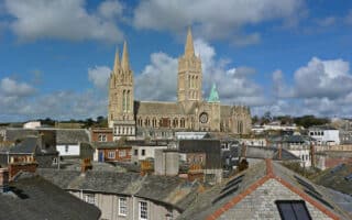
Truro is Cornwall's only city, known for its spectacular cathedral. The best place to run is along the Truro River to Malpas. In the center, see some of the sites while running up to Victoria Gardens. A run combining both these options is 5.8 miles.
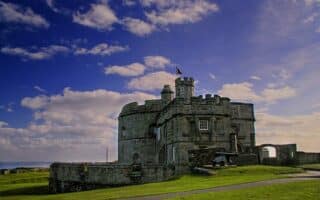
A lovely run in the port town of Falmouth, including a nice section along the harbour, and a loop around Pendennis Head, including the landmark hilltop Pendennis Castle.
In Porthleven, there's a nice run along the harbour and waterfront, including an easier section of S W Coast Path. At the east end, it connects to the Penrose National Trust, which has wonderful trails combining woodland tracks, coastline and open parkland.
There's several miles of continuous, scenic waterfront running in Penzance. Head east for 3.5 miles to St. Michael's Mount, a medieval castle reached via a dramatic causeway. Or, run west for 4 miles along the water to Newlyn and Mousehole.
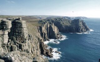
We've put together an easier 4-mile loop in Land's End -- the most westerly point of mainland England and the most visited outdoor spot in Cornwall. Smooth, gravelly paths with huge cliff and seascape views. Options for longer & challenge.
The best run in this coastal town known for its beaches and art scene is on waterfront paths to Carbis Bay. Includes The Island, Wharf Promenade, and path above the rail line with great views of St. Ives Bay. Beaches in are short but great for running.
Some great running options in the Hayle area: 3-4 miles of trails around the Hayle River estuary; fabulous beach running; and Godrevy National Trust trails, which include headland, heathland, and grassland.
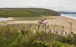
Fantastic running options in the area of this north Cornwall town. Several easier paths out to gorgeous headlands, two long, runnable beaches, routes in National Trust properties, and trail running on sections of S W Coast Path.
One of the best options in north Cornwall for a long, easy, off-road run. The multi-use trail runs along a former rail line for ~17 miles from Padstow to Wenford Bridge. The first 6 miles from Padstow to Wadebridge, along the Camel Estuary, are especially scenic.
Share your feedback on this route and see that of other Great Runs users. Click on the image icon to upload a photo. And please let us know if there are notes or changes we should incorporate!
Subscribe
0 Comments
Oldest
Newest
Inline Feedbacks
View all comments
Essentials
Combined route is 6.1 miles (10 km). Route to Northcott Mouth Beach is 3.4 miles out and back; Bude Canal Loop is 2.7 miles
Canal path is flat. Route to Northcott Mouth Beach is rolling hills
Bude, near Tourist Information Center
Large car park just north of the Tourist Information Center.


Review or Comment on This Route/Share a Photo!
Share your feedback on this route and see that of other Great Runs users. Click on the image icon to upload a photo. And please let us know if there are notes or changes we should incorporate!