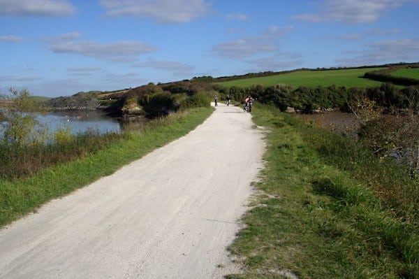
The Camel Trail offers one of the best options in north Cornwall for a long, easy, off-road run. The multi-use trail runs along a former rail line for ~17 miles from Padstow to Wenford Bridge. There’s a wonderful combination of scenery in the different sections. The path is mainly flat and mostly paved.
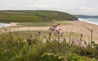
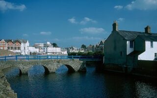
Padstow to Wadebridge. Miles 0-5.7 The most central starting spot is in Padstow, at the Harbour. Run on the Quay for 0.5 miles, then join a very scenic section along along the Camel Estuary for 5.7 miles to Wadebridge.
Wadebridge to Bodmin. Miles 6-11. Mainly wooded section.
Wadrebridge to Keybridge: Miles 11-17. Continue north along the River Camel, to Hellanbridge (Mile 14.2) and several nice bridges, ending at Keybridge (Mile 17.1, trailhead). Note the last 4 miles headed north are a gentle climb.
Optional Spur to Blisland. At Tresarrett, a scenic 1.5 mile spur section, as the trail winds its way inland to the edge of Bodmin Moor where it comes to an end below Blisland, a pretty moorland village with an award winning pub(!).
The Camel Trail offers one of the best options in north Cornwall for a long, easy, off-road run. The multi-use trail runs along a former rail line for ~17 miles from Padstow to Wenford Bridge. There’s a wonderful combination of scenery in the different sections. The path is mainly flat and mostly paved.
Padstow to Wadebridge. Miles 0-5.7 The most central starting spot is in Padstow, at the Harbour. Run on the Quay for 0.5 miles, then join a very scenic section along along the Camel Estuary for 5.7 miles to Wadebridge.
Wadebridge to Bodmin. Miles 6-11. Mainly wooded section.
Wadrebridge to Keybridge: Miles 11-17. Continue north along the River Camel, to Hellanbridge (Mile 14.2) and several nice bridges, ending at Keybridge (Mile 17.1, trailhead). Note the last 4 miles headed north are a gentle climb.
Optional Spur to Blisland. At Tresarrett, a scenic 1.5 mile spur section, as the trail winds its way inland to the edge of Bodmin Moor where it comes to an end below Blisland, a pretty moorland village with an award winning pub(!).


Review or Comment on This Route/Share a Photo!
Share your feedback on this route and see that of other Great Runs users. Click on the image icon to upload a photo. And please let us know if there are notes or changes we should incorporate!