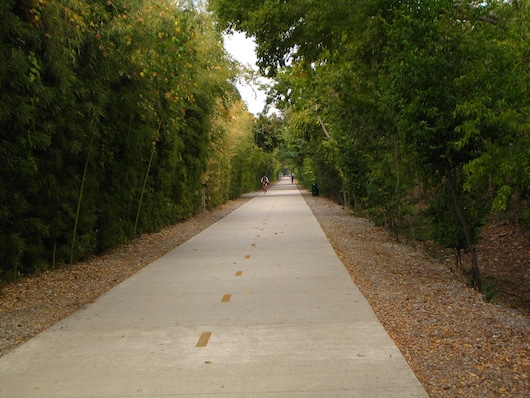
The signature run accessible from downtown Dallas is the Katy trail, a paved multi-use path that runs northeast for 3.5 milesbetween the American Airlines Center downtown and Southern Methodist University at McKinney Ave./Airline Rd., along the old Missouri-Kansas-Texas Railroad path. It’s shaded in spots and has good views of the Dallas skyline. It’s very popular, attracting 3 million visitors a year. There are lots of fun places to stop along the way, including a fun open-air beer garden called the Katy Trail Ice House. There are separate paths for those on foot and those with wheels, in sections. There are 1/4 mike markers on the trail’s surface. Sun is at your back heading east from downtown. Bonus: The trail is lit at night. Pro Tip: Can run one-way and loop back on the Turtle Creek Trail, or take DART back to downtown.
Add-On/Variety:
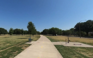
- At the north end of the Katy Trail, you can continue north on Airline Rd. into our SMU campus route, where there’s also a running track. There’s also the University Connector Trail, which runs for 2.6 miles northeast to Ridgewood Park and connects to the SOPAC Trail.
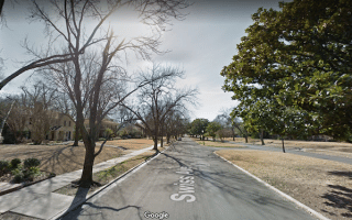
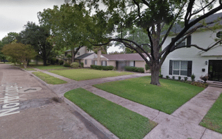
- You can add some variety by doing a loop incorporating some of the Turtle Creek trail and Turtle Creek Blvd. Cross points from the Katy Trail are Lemmon Ave., Blackburn Ave., Fitshugh, and Armstrong. Note that Turtle Creek is not as seamless as the Katy Trail — there are road crossings. At the eastern end, there are pleasant residential streets in the Highland neighborhood.
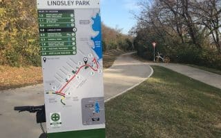
- NEW [2025]: The Hi Line Connector is a new 1-mile paved trail linking the Katy Trail @Victory Ave. and the Trinity Strand Trail just north of Turtle Creek Blvd.
If you’ll be downtown, try to stay within a mile of the Katy Trail, which can be accessed from N. Houston St./Victory Ave. and the American Airlines Center at Victory Park.
More Info on Katy Trail
The signature run accessible from downtown Dallas is the Katy trail, a paved multi-use path that runs northeast for 3.5 milesbetween the American Airlines Center downtown and Southern Methodist University at McKinney Ave./Airline Rd., along the old Missouri-Kansas-Texas Railroad path. It’s shaded in spots and has good views of the Dallas skyline. It’s very popular, attracting 3 million visitors a year. There are lots of fun places to stop along the way, including a fun open-air beer garden called the Katy Trail Ice House. There are separate paths for those on foot and those with wheels, in sections. There are 1/4 mike markers on the trail’s surface. Sun is at your back heading east from downtown. Bonus: The trail is lit at night. Pro Tip: Can run one-way and loop back on the Turtle Creek Trail, or take DART back to downtown.
Add-On/Variety:
- At the north end of the Katy Trail, you can continue north on Airline Rd. into our SMU campus route, where there’s also a running track. There’s also the University Connector Trail, which runs for 2.6 miles northeast to Ridgewood Park and connects to the SOPAC Trail.
- You can add some variety by doing a loop incorporating some of the Turtle Creek trail and Turtle Creek Blvd. Cross points from the Katy Trail are Lemmon Ave., Blackburn Ave., Fitshugh, and Armstrong. Note that Turtle Creek is not as seamless as the Katy Trail — there are road crossings. At the eastern end, there are pleasant residential streets in the Highland neighborhood.
- NEW [2025]: The Hi Line Connector is a new 1-mile paved trail linking the Katy Trail @Victory Ave. and the Trinity Strand Trail just north of Turtle Creek Blvd.
If you’ll be downtown, try to stay within a mile of the Katy Trail, which can be accessed from N. Houston St./Victory Ave. and the American Airlines Center at Victory Park.
More Info on Katy Trail


Review or Comment on This Route/Share a Photo!
Share your feedback on this route and see that of other Great Runs users. Click on the image icon to upload a photo. And please let us know if there are notes or changes we should incorporate!