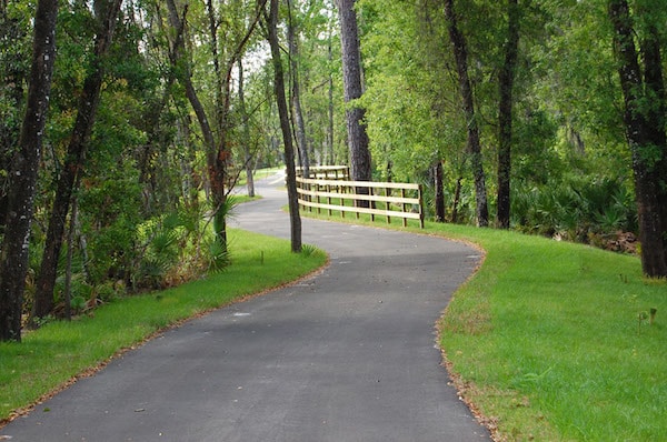
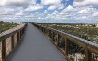
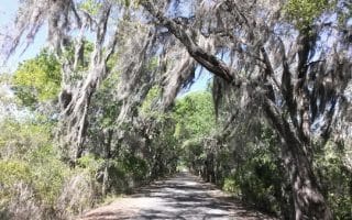
The paved Spring-to-Spring Trail is a continually improving multi-use trail in Volusia County, about 25 miles west of Daytona Beach. The trail is so-named because it connects several springs in the central Florida area north of Orlando. Many sections of the trail are wooded, skirting numerous inland parks.
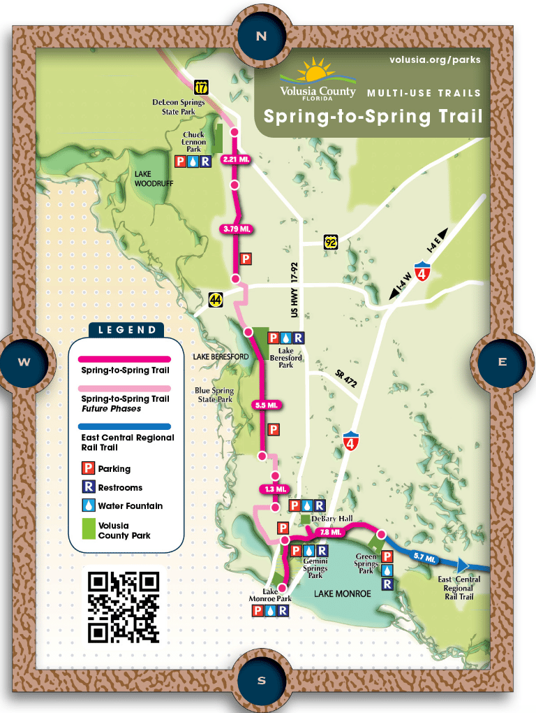
Overall, the trail is planned to be 26 miles from DeLeon Springs Park south to Green Springs Park (and connection to the East Central Regional Rail Trail). Today, there are ~20 completed miles, shown in this overview map, divided into three sections, from north to south.
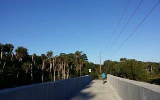
Chuck Lennon Park to Square Dog Park. 6 miles. Northern terminus of the trail is currently at Chuck Lennon Park, near DeLeon Springs Park. The southern end of this section, at Square Dog Park, is just off Rt. 44 and is the closest access point to Daytona Beach, 20 miles to the east. There’s a parking lot here. There’s a 2-3 mile gap in the trail between Square Dog Park to where it picks up again in Lake Beresford Park. MAP
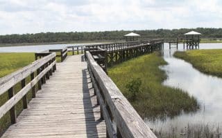
Lake Beresford Park to Blue Spring State Park(French Ave.). 5.3 miles. And then another 2.4 miles south of Blue Spring State Park, also referred to as the Lake Beresford Pathway. Very nice section, mainly wooded, passing through two parks. MAPAdd-on: 2 mile loop around Lake Bersford Park.
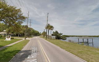
Lake Monroe to Green Springs Park. 8.1 miles. Pick up the western section at Lake Monroe Park, just off I-4. One of our favorite sections is the 3.2 miles east to Gemini Springs Park (parking), along the Pat Northey Pathway. From Gemini Springs Park, it’s 5 miles east to Green Springs Park (0.4 mile spur to De Bary Hall Historic Site), along the DeBary Pathway and the Green Springs Pathway. At Green Springs Park, connect to the East Central Regional Rail Trail for even more miles! MAP
Volusia.org/parks
The paved Spring-to-Spring Trail is a continually improving multi-use trail in Volusia County, about 25 miles west of Daytona Beach. The trail is so-named because it connects several springs in the central Florida area north of Orlando. Many sections of the trail are wooded, skirting numerous inland parks.
Overall, the trail is planned to be 26 miles from DeLeon Springs Park south to Green Springs Park (and connection to the East Central Regional Rail Trail). Today, there are ~20 completed miles, shown in this overview map, divided into three sections, from north to south.
Chuck Lennon Park to Square Dog Park. 6 miles. Northern terminus of the trail is currently at Chuck Lennon Park, near DeLeon Springs Park. The southern end of this section, at Square Dog Park, is just off Rt. 44 and is the closest access point to Daytona Beach, 20 miles to the east. There’s a parking lot here. There’s a 2-3 mile gap in the trail between Square Dog Park to where it picks up again in Lake Beresford Park. MAP
Lake Beresford Park to Blue Spring State Park(French Ave.). 5.3 miles. And then another 2.4 miles south of Blue Spring State Park, also referred to as the Lake Beresford Pathway. Very nice section, mainly wooded, passing through two parks. MAPAdd-on: 2 mile loop around Lake Bersford Park.
Lake Monroe to Green Springs Park. 8.1 miles. Pick up the western section at Lake Monroe Park, just off I-4. One of our favorite sections is the 3.2 miles east to Gemini Springs Park (parking), along the Pat Northey Pathway. From Gemini Springs Park, it’s 5 miles east to Green Springs Park (0.4 mile spur to De Bary Hall Historic Site), along the DeBary Pathway and the Green Springs Pathway. At Green Springs Park, connect to the East Central Regional Rail Trail for even more miles! MAP
Scroll Down For Route Maps
Essentials
Overall, about 20 miles, divided into 3 larger sections
Generally flat, with some small hills
Deppends on section chosen
Several key access points & parking areas -- see overview map
One of the best beaches for running in the United States. This wide beach featuring 23 miles of packed sand stretches from Ponce Inlet in the south to Ormond Beach in the north. There are boardwalks/nature trails in several beachfront parks.
A very pretty run, exploring some of the historic sections of Daytona Beach and some waterfront roads along the Halifax River, and around City Island and Halifax Marina. One of the best options for road running in the area.
Popular 33-mile 'scenic loop (drive)' in the Ormond Beach area. We've annotated the map and described some of the best sections for running. There are ocean views, marsh views, and some lovely shaded sections with a nice canopy.
Just across Ponce Inlet from Daytona Beach, New Smyrna Beach offers 17 miles of terrific beachfront running. It's generally flat and features firm, packed sand. At the northern end, Smyrna Dunes Park has a wonderful 1.6 mile boardwalk trail.
Wonderful park at the northern end of New Smyrna Beach, featuring a 1.6 mile boardwalk trail winding through through and over dunes. Ocean views, shaded canopy, sections of desert-like terrain. Longer run: Additional nature trails, New Smyrna Beach.
As a variation from the beach, some excellent running options: Downtown historic district has pretty homes on tree-lined streets; Riverside Drive has 4 miles of running along the Indian River; and the 2-mile New Smyrna Beach Multi-Use Trail.
A good off-road running option in the New Smyrna Beach area. It runs for 2.2 miles from West Pine Ave. at the edge of downtown, west to Sugar Mill Dr. One highlight of the trail is a 125-foot bridge over Turnbull Creek.
Large preserve overlooking the Spruce Creek River with 3 miles of nature trails and ~10 miles of bike trails. Good opportunity for off-road & trail running. Mix of open & wooded, some water views. Located 6 miles west of New Smyrna Beach.
There are lots of options to get in miles and miles of running along the area's extensive multi-use trail network. Most of them are inland. This is a list of some of our favorite trails, from Palm Coast to Edgewater, and west to Lake Monroe.
Share your feedback on this route and see that of other Great Runs users. Click on the image icon to upload a photo. And please let us know if there are notes or changes we should incorporate!
Subscribe
0 Comments
Oldest
Newest
Inline Feedbacks
View all comments
Essentials
Overall, about 20 miles, divided into 3 larger sections
Generally flat, with some small hills
Deppends on section chosen
Several key access points & parking areas -- see overview map


Review or Comment on This Route/Share a Photo!
Share your feedback on this route and see that of other Great Runs users. Click on the image icon to upload a photo. And please let us know if there are notes or changes we should incorporate!