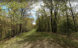
The Chippewa River State Trail is the anchor of running in Eau Claire. This rails-to-trails multi-use path runs for 30 miles between Eau Claire and Durand, with terrain that includes some waterfront sections, prairies, sandstone bluffs and wetlands. The trail is paved for the first 11 miles between Eau Claire and Caryville and the last 6.5 miles between Red Cedar and Durand. The middle 12.5 miles are asphalt emulsion.
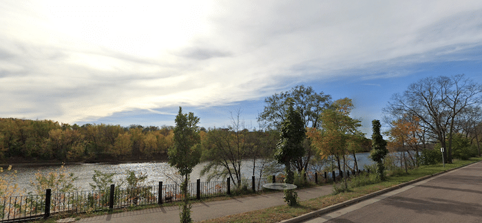
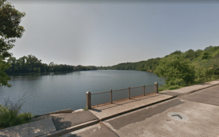
Choose any section of this trail! The first 2.5 miles between the Eau Claire start in Phoenix Park and Highway 12 are right along the Chippewa River, and are quite scenic. So this would make a nice 5 mile out and back. There are also some nice loop options, with three pedestrian bridges and nice riverside streets on the east side of the river (see our River Loop route), and connections to other centrally located paths and parks in Eau Claire. South of Highway 12, the trail turns inland.
The Chippewa River State Trail is the anchor of running in Eau Claire. This rails-to-trails multi-use path runs for 30 miles between Eau Claire and Durand, with terrain that includes some waterfront sections, prairies, sandstone bluffs and wetlands. The trail is paved for the first 11 miles between Eau Claire and Caryville and the last 6.5 miles between Red Cedar and Durand. The middle 12.5 miles are asphalt emulsion.
Choose any section of this trail! The first 2.5 miles between the Eau Claire start in Phoenix Park and Highway 12 are right along the Chippewa River, and are quite scenic. So this would make a nice 5 mile out and back. There are also some nice loop options, with three pedestrian bridges and nice riverside streets on the east side of the river (see our River Loop route), and connections to other centrally located paths and parks in Eau Claire. South of Highway 12, the trail turns inland.


Review or Comment on This Route/Share a Photo!
Share your feedback on this route and see that of other Great Runs users. Click on the image icon to upload a photo. And please let us know if there are notes or changes we should incorporate!