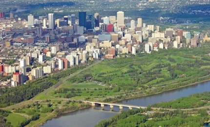
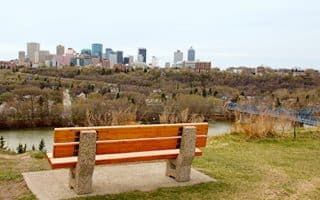
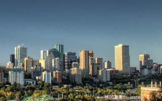
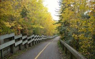
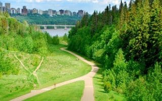
The North Saskatchewan River Valley is the largest urban park in Canada, with 160 km of maintained trails and 20 major parks. Running along the River Valley trails is fantastic — accessible to downtown, on paved trails, with water views and wonderful parks. There are trails on the north and south sides of the river, with bridges at decent intervals providing for good loop options. Many of Edmonton’s major sites are located along these trails.
Here, we provide information on the entirety of the paths on both sides of the river, with tables providing info on distances between the major way points.
North Side. 13.8 km one-way from the Capilano Footbridge in the east to 142nd St. The 7 km section between MacDonald Bridge (Low-Level Bridge) and the Groat St. Bridge (Government Center Park/Legislature) is closest to downtown and the Conference Center and has many highlights. For some extra burn, do the stairs around the Low Level Bridge!
A spur from 142nd. St. south to Sir Wilfred Laurier Park/Edmonton Zoo is an additional 5 km one-way, which includes a footbridge at Buena Vista Park, leading to Heritage Amphitheatre and south side trails.
South Side. From Tiger Goldstick Park to Fort Edmonton is 23.3 km. This side is hillier. Highlights here (west to east) are the Botanical Gardens and the Kinsmen Sports Center.
North Side Segment Table
South Side Segment Table
The City of Edmonton has two excellent maps, providing more detail on path distances, features, landmarks, recreational opportunities, and parking. Note: the winter map focuses on winter-oriented activities, with information on which sections of the path are cleared of snow (for walking & running).
Detailed Park Map: Summer
Park Map: Winter

Review or Comment on This Route/Share a Photo!
Share your feedback on this route and see that of other Great Runs users. Click on the image icon to upload a photo. And please let us know if there are notes or changes we should incorporate!