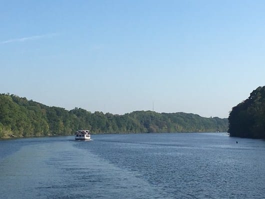
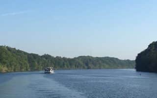
Runners can enjoy many scenic miles of the Erie Canal Towpath in the Syracuse area. The lengthy multi-use path runs along the historic Erie Canal from Buffalo to Albany. It’s popular with runners for its relatively flat surface, water views, and historic sites. This interactive map is the best way to plot out your favorite section. The path in the area of downtown Syracuse isn’t all that pleasant or seamless, and there are a few miles of on-road section. Instead, we’ve mapped two sections in the Syracuse area: a 10.5-mile eastern route, from Dewitt (7 miles east of downtown Syracuse) to Chittenango Landing; and a 12-mile western route, from Camillus (7 miles west of downtown) to Jordan. Choose any section you like! On the interactive map, red is paved, purple is stone dust, and gray is on-road.
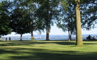
For the western section, start at Reed Webster Park. Continue for up to 12 miles west, on the north side of the canal. The surface is stone dust. It’s 4 miles to Warners, 6 miles to Memphis, and 11.9 miles to Jordan. You can continue 8 miles further west to Port Byron, passing through Weedsport (2-mile on-road section in Weedsport).
Runners can enjoy many scenic miles of the Erie Canal Towpath in the Syracuse area. The lengthy multi-use path runs along the historic Erie Canal from Buffalo to Albany. It’s popular with runners for its relatively flat surface, water views, and historic sites. This interactive map is the best way to plot out your favorite section. The path in the area of downtown Syracuse isn’t all that pleasant or seamless, and there are a few miles of on-road section. Instead, we’ve mapped two sections in the Syracuse area: a 10.5-mile eastern route, from Dewitt (7 miles east of downtown Syracuse) to Chittenango Landing; and a 12-mile western route, from Camillus (7 miles west of downtown) to Jordan. Choose any section you like! On the interactive map, red is paved, purple is stone dust, and gray is on-road.
For the western section, start at Reed Webster Park. Continue for up to 12 miles west, on the north side of the canal. The surface is stone dust. It’s 4 miles to Warners, 6 miles to Memphis, and 11.9 miles to Jordan. You can continue 8 miles further west to Port Byron, passing through Weedsport (2-mile on-road section in Weedsport).


Review or Comment on This Route/Share a Photo!
Share your feedback on this route and see that of other Great Runs users. Click on the image icon to upload a photo. And please let us know if there are notes or changes we should incorporate!