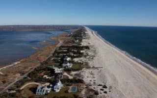
Fire Island is the large center island of the outer barrier islands parallel to the south shore of Long Island, New York. It is a popular recreation destination. The island is 32 miles long — 26 miles are controlled by the Fire Island National Seashore and 6 miles by Robert Moses State Park. It is car-free, except for access via Robert Moses Causeway on its western end, and by William Floyd Parkway (Suffolk County Road 46) near its eastern end. Access is also via numerous ferries.
Fire Island is large and quite wild. The best running spots in the National Seashore section are on the western end of the island. Among the highlights is a series of boardwalk trails. There are also several trails and roads that are good for running, but have varied surfaces. The beach, while extensive and beautiful, features mainly softer sand and might not be great for running. Below is a list of some recommended running spots.
National Seashore:
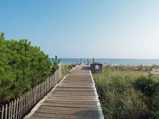
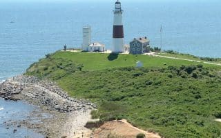
- Fire Island Lighthouse route. Lovely boardwalk trail, ~1 mile each way from Robert Moses Field 5
- Sunken Forest. About 2 miles of paved trails through one of the only preserved Maritime Forests on the east coast. Lovely and shaded. Near Sailors Haven Visitor Center.
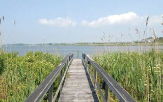
- Watch Hill: Some nice boardwalk running around a salt marsh, near the Watch Hill Visitor Center.
- Roads: It is possible to run along Robert Moses State Parkway, between Robert Moses State Park and Burma Rd., which is 3.7 miles. The road is paved but there no shoulder. Burma Rd. east to Kismet is another 1 mile.
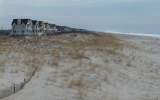
Towns. There are some pleasant, and delightfully car-free roads in the main Fire Island towns between Robert Moses State Park and the National Seashore — Kismet, Saltaire, Fair Harbor, Atlantique, Ocean Beach
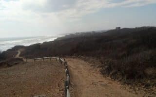
Robert Moses State Park. At the western end of Fire Island. 5 miles of shoreline, multiple nature trails and sand trails. Some good running spots. Sand trails might be too soft for running. MAP
Ferry Schedule
Fire Island National Seashore Info
Robert Moses State Park Map
Fire Island is the large center island of the outer barrier islands parallel to the south shore of Long Island, New York. It is a popular recreation destination. The island is 32 miles long — 26 miles are controlled by the Fire Island National Seashore and 6 miles by Robert Moses State Park. It is car-free, except for access via Robert Moses Causeway on its western end, and by William Floyd Parkway (Suffolk County Road 46) near its eastern end. Access is also via numerous ferries.
Fire Island is large and quite wild. The best running spots in the National Seashore section are on the western end of the island. Among the highlights is a series of boardwalk trails. There are also several trails and roads that are good for running, but have varied surfaces. The beach, while extensive and beautiful, features mainly softer sand and might not be great for running. Below is a list of some recommended running spots.
National Seashore:
- Fire Island Lighthouse route. Lovely boardwalk trail, ~1 mile each way from Robert Moses Field 5
- Sunken Forest. About 2 miles of paved trails through one of the only preserved Maritime Forests on the east coast. Lovely and shaded. Near Sailors Haven Visitor Center.
- Watch Hill: Some nice boardwalk running around a salt marsh, near the Watch Hill Visitor Center.
- Roads: It is possible to run along Robert Moses State Parkway, between Robert Moses State Park and Burma Rd., which is 3.7 miles. The road is paved but there no shoulder. Burma Rd. east to Kismet is another 1 mile.
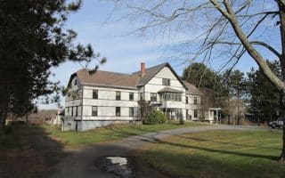
Towns. There are some pleasant, and delightfully car-free roads in the main Fire Island towns between Robert Moses State Park and the National Seashore — Kismet, Saltaire, Fair Harbor, Atlantique, Ocean Beach
Robert Moses State Park. At the western end of Fire Island. 5 miles of shoreline, multiple nature trails and sand trails. Some good running spots. Sand trails might be too soft for running. MAP
Ferry Schedule
Fire Island National Seashore Info
Robert Moses State Park Map


Review or Comment on This Route/Share a Photo!
Share your feedback on this route and see that of other Great Runs users. Click on the image icon to upload a photo. And please let us know if there are notes or changes we should incorporate!