Features:
Categories:
For a combination of scenery and challenge, run along the Nature Preserve of the Upper Rock. Combine the narrow and hilly roads with some of the footpaths. The map below provides a good overview (roads are black, trails are colored), and this article has details on the different paths. One can run/hike to the summit, or take a cable car from the station just south of town. For a true trail running challenge, run/hike up the famous Mediterranean Steps, and then enjoy some of the roads/footpaths from O’Hara’s Battery at the summit.

Roads. Best bet is Queen’s Rd., which runs for 3 km one-way along the length of the Preserve. It’s hilly, but not a killer: 67m, north to south. For a nice add-on (and more hills, a come off Queen’s Rd. and take Spur Battery Rd. and/or O’Hara’s Rd. This can add another 2-3 km one-way, and about 2x the elevation gain. Note the roads is narrow, and no shoulder.
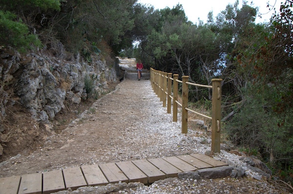
Footpaths. These are more for trail running and are generally hilly. Used a lot by walkers and hikers, so can be busy. Inglis Way traverses the middle section of the Upper Rock for 1.2 km from Queen’s Gate to Bruces Farm. Royal Anglican Way is 600m from Apes Den to St. Michael’s Cave.
Mediterranean Steps. These steps carved into the rock are a must-do on Gibraltar. They traverse for 1.8 km between Jews’ Gate and O’Hara’s Battery. This can be a challenging hike/run, but they tend to be quite crowded, which might be frustrating for runners.
- Depends on option chosen. Queen's Road is 3 km one-way
- Depends on trail, but ranges from hilly to super steep
- Depends on option chosen.
- Can walk/hike to summit or take the cable car


Comment on this Route/Share a Photo!
Share your feedback on this route and see that of other Great Runs users. Click on the image icon to upload a photo. And please let us know if there are notes or changes we should incorporate!