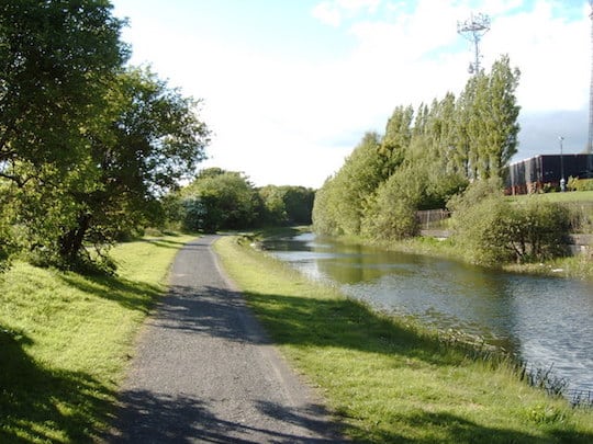
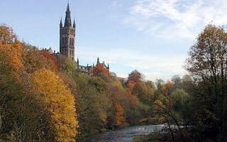
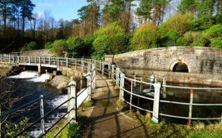
The routes along the Clyde and Kelvin rivers are great, but they are hugely popular. For a waterfront run away from the crowds, track the path along the canal from Spiers Wharf up to Ruchill Park, which locals say is the best panoramic view of the city. This is great for a sunrise or sunset run. The canal trail will take you to the more secluded outskirts of the city, so you may want to bring a buddy, but this peaceful route with great views is worth going out of your way for. The surface varies — there’s even cobblestone, but there’s also usually a small path right along the water good for running.
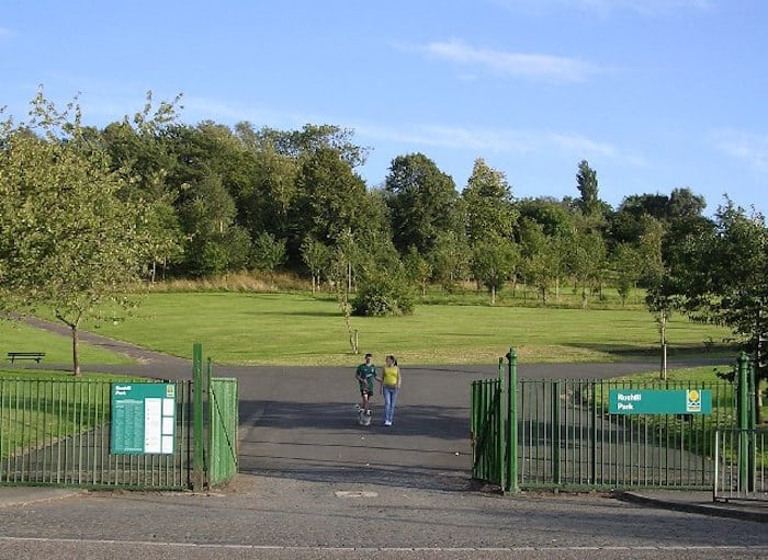
Ruchill Park
Our route is a 6.5 mile out and back to Ruchill Park, including a loop around the park. It’s possible to continue north and do many more km along the canal paths. About 1 km north of Ruchill Park, at Lochburn Rd., we recommend heading east, where there are paths for about as much mileage as you’d like to do.
The routes along the Clyde and Kelvin rivers are great, but they are hugely popular. For a waterfront run away from the crowds, track the path along the canal from Spiers Wharf up to Ruchill Park, which locals say is the best panoramic view of the city. This is great for a sunrise or sunset run. The canal trail will take you to the more secluded outskirts of the city, so you may want to bring a buddy, but this peaceful route with great views is worth going out of your way for. The surface varies — there’s even cobblestone, but there’s also usually a small path right along the water good for running.
Ruchill Park
Our route is a 6.5 mile out and back to Ruchill Park, including a loop around the park. It’s possible to continue north and do many more km along the canal paths. About 1 km north of Ruchill Park, at Lochburn Rd., we recommend heading east, where there are paths for about as much mileage as you’d like to do.
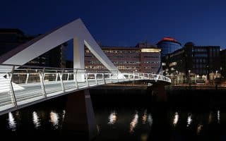
We love this route that criss-crosses the River Clyde on some of Glasgow’s most interesting architectural feats. We've mapped a 7.4 km loop, but there are many options for vary the length given there's never more than 1 km between the bridges.
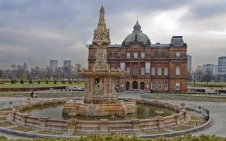
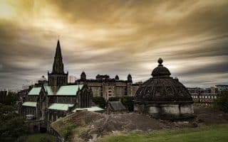
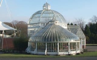
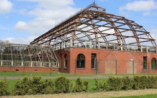
Glasgow's oldest park and a popular running spot. Run along the Clyde River and in the Green, past the People's Palace and Winter Garden. Several other architectural highlights and landmarks, and lovely running paths.
The West End of Glasgow is most noteworthy where the Clyde intersects with the Kelvin, making for a stretch of beautiful waterfront park — especially the Riverside Museum on the Broomielaw, where you can check out the historic tall ships.
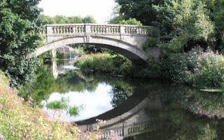
These interconnected parks are just south of Glasgow and easily accessible by transport. Enjoy the skyline view from Queen’s Park and the gardens at Pollok Park. Our route outlines both parks but there are great DIY options.
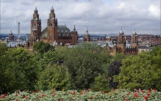
Create your own run incorporating Kelvingrove Park (one of Glasgow's oldest parks), the pretty grounds and buildings of the University of Glasgow Campus, and the 27-acre Botanical Garden, which is free to enter.
Extensive trail network in this park only 20 minutes north of the city by train. Good options for trail running and hills, passing by remains of castles, World War anti-aircraft trenches, and other sites.
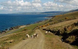
An easy and accessible section of this stunning 100-mile coastal path. Starting near the West Kilbride train station (45 min. from Glasgow) the route follows a forested glen downhill and then the coast north for 10+ miles to Largs. Water views, beach, castles!
Share your feedback on this route and see that of other Great Runs users. Click on the image icon to upload a photo. And please let us know if there are notes or changes we should incorporate!
Subscribe
0 Comments
Oldest
Newest
Inline Feedbacks
View all comments
Essentials
6.6 km (4.1 miles) out and back, with much more possible
68 meters (223 feet)
Start out on the southeast end of the canal near Spiers Wharf


Review or Comment on This Route/Share a Photo!
Share your feedback on this route and see that of other Great Runs users. Click on the image icon to upload a photo. And please let us know if there are notes or changes we should incorporate!