Gran Canaria is home to numerous lively beaches. There are some nice waterfront running options on seafront promenades and beaches. Here are some of our favorites:
Puerto Rico Beach. ~5 km out and back. In the Puerto Rico beach area, a popular waterfront promenade runs from Puerto Rico Beach north to Amadores Beach. Both beaches are decent for running, too. ROUTE MAP

Playa del Inglés Area. This is a popular beach, with two good running options (that can be combined!). From the Tourist/Info Center.
- Run north towards San Agustin. It’s a combination runnable beach and seafront promenade below spectacular sand cliffs. ~8 km km out and back, 51m gain. ROUTE MAP (courtesy Keith Hauser).
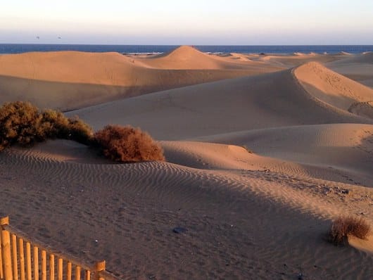
- Run south toward the Faro de Maspalomas (lighthouse), past the spectacular Maspalomas Dunes. This is mainly beach running (very wide beach). One can walk/hike in the dunes, though for running it’s challenging soft sand. 5 km from Playa del Inglés to the lighthouse.
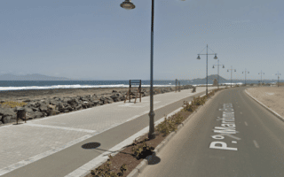
Puerto Arguineguín to Puerto Anfi (puerto=marina). A nice 10k out and back between these two marinas on the western side of Gran Canaria. Mostly seafront promenade or sidewalk along road, as you rise out from Arguineguín above the water. 10 km out & back, 114m gain. ROUTE MAP
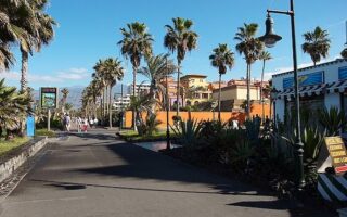
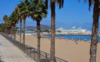
Las Palmas Area. Some wonderful running on the northern part of Gran Canaria in Las Palmas. Around Playa de Las Canteras, famous for its surfing & snorkeling, a scenic waterfront promenade runs for 5 km to Puntilla Beach, then along Playa de Las Canteras to Plaza de la Música. Great water views and lots of people. ROUTE MAP
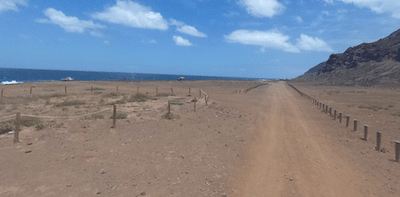
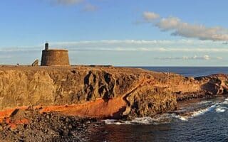
Isleta Peninsula/Nature Preserve. Scenic and slightly more rugged running on the Isleta peninsula. From Puntilla Beach, there’s a nice waterfront promenade for ~2 km, then at Mirador (viewpoint) Confital, the promenade becomes more of a car-free dirt path/road, with cliffs on the right and water to the left. The path passes several viewpoints (mirador) for another ~ 3 km. Very scenic and a decent surface. There are some additional paths in the Isleta Nature Preserve. Up to 5 km one-way, 94m gain (one-way). ROUTE MAP
Playa de Las Alcaravaneras. On the eastern side of Las Palmas, one can put together a nice ~6.5 km out and back run along the promenade along Playa de Las Alcaravaneras, then out to the Marina, and then a little jaunt inland to the Monumento Atis Tirma (large fountain with bronze sculptures), the Jardines del Hotel Santa Catalina, and Parque Doramas. The 1.5 km beach is also rubbable. 6.5 km out and back. ROUTE MAP
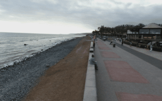
East Side of Gran Canaria Bike Path. There is paved bike path that goes south along the east coast of Gran Canaria quite seamlessly for ~12 km between Playa de Las Alcaravaneras and Playa de la Laja. The path is well separated from the main road. There are fantastic water views, although you will be along a busy road in parts. There are even separate bike/pedestrian paths in some sections.

Review or Comment on This Route/Share a Photo!
Share your feedback on this route and see that of other Great Runs users. Click on the image icon to upload a photo. And please let us know if there are notes or changes we should incorporate!