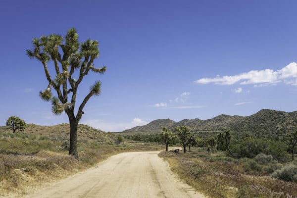
The main paved roads in the park tend to have a lot of traffic and lack a shoulder, so we generally don’t recommend those for running. A much better option is to run on some of the designated the backcountry roads in Joshua Tree National Paarkj that are open for four-wheel drive vehicles and mountain biking. There are many miles of these roads, which vary in surface conditions and level of difficulty. The roads can be rocky and/or sandy, and there are some routes that are very hilly. Note: Read the descriptions or talk to a park ranger, as some of the roads have deep sand.
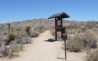
This Park page has good information on the backcountry roads. Among the easier/moderate routes that are best for running:
Queen Valley Roads. There are 13.4 miles of roads accessible from Barker Dam or Big Horn Pass. The surface conditions are easier, though can be sandy.
Covington Flat Roads. These roads offer access to some of the park’s largest Joshua trees, junipers, and pinyon pines. They also provide access to some of the higher and cooler elevations in the park. Run up to 3.8 miles one-way from the Lower Covington Flat picnic area to Eureka Peak.
Pinkham Canyon Road. Accessible from the Cottonwood Visitor Center. The first few miles of this road have a decent surface for running, but becomes more difficult for running as the road turns south into Pinkham Canyon.
The main paved roads in the park tend to have a lot of traffic and lack a shoulder, so we generally don’t recommend those for running. A much better option is to run on some of the designated the backcountry roads in Joshua Tree National Paarkj that are open for four-wheel drive vehicles and mountain biking. There are many miles of these roads, which vary in surface conditions and level of difficulty. The roads can be rocky and/or sandy, and there are some routes that are very hilly. Note: Read the descriptions or talk to a park ranger, as some of the roads have deep sand.
This Park page has good information on the backcountry roads. Among the easier/moderate routes that are best for running:
Queen Valley Roads. There are 13.4 miles of roads accessible from Barker Dam or Big Horn Pass. The surface conditions are easier, though can be sandy.
Covington Flat Roads. These roads offer access to some of the park’s largest Joshua trees, junipers, and pinyon pines. They also provide access to some of the higher and cooler elevations in the park. Run up to 3.8 miles one-way from the Lower Covington Flat picnic area to Eureka Peak.
Pinkham Canyon Road. Accessible from the Cottonwood Visitor Center. The first few miles of this road have a decent surface for running, but becomes more difficult for running as the road turns south into Pinkham Canyon.
Review or Comment on This Route/Share a Photo!
Share your feedback on this route and see that of other Great Runs users. Click on the image icon to upload a photo. And please let us know if there are notes or changes we should incorporate!