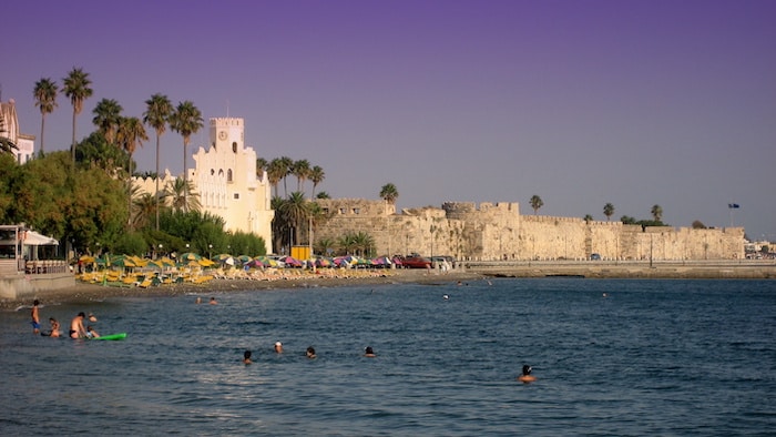
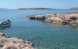
Kos is an island in the Dodecanese archipelago featuring sandy beaches and a number of Greek & Roman ruins. There’s some lovely running on Kos. Below is some scenic waterfront running in the town of Kos, the island’s main town and population center, and in nearby Tigaki. See our other post for routes in the Kefalos area.
Kos area waterfront. Google Street View
Kos Waterfront. We’ve mapped ~12 km of waterfront running in the area around Kos. It’s mainly along a sidewalk, with a few sections of dedicated seafront promenade. Not all of this is right along the water. A few options:
From the center of Kos, one can run for up to 7 km east to Psalidi Beach. This includes a nice section around the marina, and then to the Plane Tree of Hippocrates and Neratzia Castle.
For a very scenic, historic out and back, run from the center of Kos to the Castle, then to the marina and Paradiso Beach. This would be ~8 km out and back.
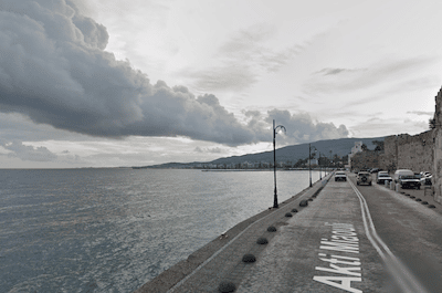
West to Aeolos Beach. From Kos, follow the main road along the water around the northern tip of the island, then along the Αιγαίου road to the end. It’s ~5 km from the center of Kos to Aeolos Beach.
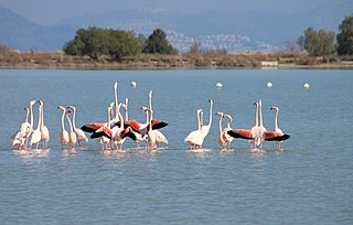
Flamingos at Alikes. CC: Tracy Gymellas
Tigaki. About 10 km west of Kos, there’s some nice waterfront running in Tigaki, including a path around part of Alikes Salt Lake. From the center of the small town, it’s 2 km east along the water on the main road. Nice water views and lots of fun restaurants and bars! (note: no sidewalk). Then run on the path around the lake. It’s a lovely wetlands area, and you might see migrating flamingos and pelicans outside the summer months! The path doesn’t make a full loop — it’s ~2.5 km to the end of the path at Golden Beach.
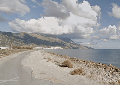
Golden Beach is runnable right along the water.
Kardamaina Waterfront & Hills. There’s ~6 km of nice waterfront running in this resort town near the airport known for its long, sandy beach, which is lined with bars, tavernas and nightclubs. From the center of town, run for 4 km north to Vali’s Beach, and 2 km south to where the waterfront road starts to turn inland.
For some scenic, hilly running, head up the road from town to Antimachia Castle, the remnants of a former military structure, built in the Middle Ages & offering panoramic views. A 3 km, 165m climb!Kardamaina Waterfront Headed North. Google Street View
Kos is an island in the Dodecanese archipelago featuring sandy beaches and a number of Greek & Roman ruins. There’s some lovely running on Kos. Below is some scenic waterfront running in the town of Kos, the island’s main town and population center, and in nearby Tigaki. See our other post for routes in the Kefalos area.
Kos area waterfront. Google Street View
Kos Waterfront. We’ve mapped ~12 km of waterfront running in the area around Kos. It’s mainly along a sidewalk, with a few sections of dedicated seafront promenade. Not all of this is right along the water. A few options:
From the center of Kos, one can run for up to 7 km east to Psalidi Beach. This includes a nice section around the marina, and then to the Plane Tree of Hippocrates and Neratzia Castle.
For a very scenic, historic out and back, run from the center of Kos to the Castle, then to the marina and Paradiso Beach. This would be ~8 km out and back.
West to Aeolos Beach. From Kos, follow the main road along the water around the northern tip of the island, then along the Αιγαίου road to the end. It’s ~5 km from the center of Kos to Aeolos Beach.
Flamingos at Alikes. CC: Tracy Gymellas
Tigaki. About 10 km west of Kos, there’s some nice waterfront running in Tigaki, including a path around part of Alikes Salt Lake. From the center of the small town, it’s 2 km east along the water on the main road. Nice water views and lots of fun restaurants and bars! (note: no sidewalk). Then run on the path around the lake. It’s a lovely wetlands area, and you might see migrating flamingos and pelicans outside the summer months! The path doesn’t make a full loop — it’s ~2.5 km to the end of the path at Golden Beach.
Golden Beach is runnable right along the water.
Kardamaina Waterfront & Hills. There’s ~6 km of nice waterfront running in this resort town near the airport known for its long, sandy beach, which is lined with bars, tavernas and nightclubs. From the center of town, run for 4 km north to Vali’s Beach, and 2 km south to where the waterfront road starts to turn inland.
For some scenic, hilly running, head up the road from town to Antimachia Castle, the remnants of a former military structure, built in the Middle Ages & offering panoramic views. A 3 km, 165m climb!Kardamaina Waterfront Headed North. Google Street View
Scroll Down For Route Maps
Essentials
Kos Area: Up to 12 km (7.5 miles) along the water. Choose a section! Tigaki Area: Waterfront & Lake is ~14 km (8.5 miles) for complete route. Kardamaina: ~6 km along the water
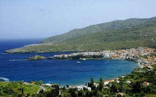
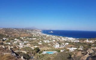
Mountainous island is the northernmost of the Cyclades archipelago. There are some nice waterfront routes in the main towns, and an extensive network of quiet roads and trails in the hilly interior.
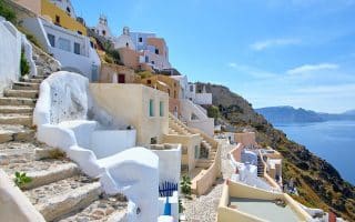
Perhaps the most popular island for tourists in Greece, picturesque Santorini has great running along the Kamari and Perissa Beach boardwalks, but the crown jewel is the path between Fira and Oia, which is more of a trail run.
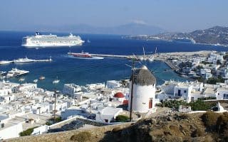
The best running on the lively, well-known island of Mykonos is right along the waterfront of Mykonos town. End at the Windmills of Kato Milli for a scenic treat. Also some good running on some scenic coastal and interior roads.
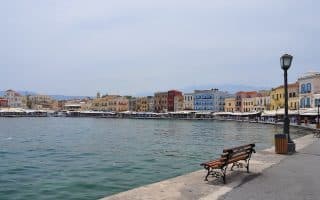
Crete, the largest of the Greek Islands, has three major cities with shoreline promenades as well as 320 km of the cross-Europe E4 Trail. Also a nice trail run in Plakias.
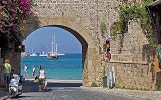
In addition to some great waterfront sidewalks, the island of Rhodes has some of the most unique historic running in the Greek Islands, with the trail along the former Old Town moat.
Some wonderful seaside & hillside running in the Kampos & Kefalos area. Quaint villages, panoramic water views, Roman ruins, and beautiful countryside. Away from the water it's hilly!
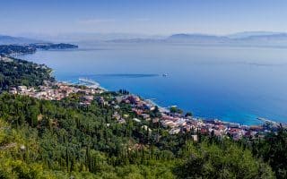
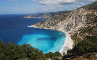
Several lovely waterfront routes on the sixth largest of the Greek Islands. A highlight is the 10+ km along the water in the capital of Argostoli. Other good areas are Skala Beach, Poros, and Lixouri.
In Paros, the best place to run in a waterfront tour of Parikia Bay. In Antiparos, there's some good waterfront running as well, and a run from the Chapel of Saint Marina to Sifneikos Beach.
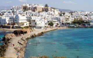
The best places to run on Naxos are along the waterfront in the main city of Chora, several great beaches for running on the southwest coast, along interior farm roads, and several routes and through villages featuring historic churches, temples, and ancient ruins.
Share your feedback on this route and see that of other Great Runs users. Click on the image icon to upload a photo. And please let us know if there are notes or changes we should incorporate!
Subscribe
0 Comments
Oldest
Newest
Inline Feedbacks
View all comments
Essentials
Kos Area: Up to 12 km (7.5 miles) along the water. Choose a section! Tigaki Area: Waterfront & Lake is ~14 km (8.5 miles) for complete route. Kardamaina: ~6 km along the water


Review or Comment on This Route/Share a Photo!
Share your feedback on this route and see that of other Great Runs users. Click on the image icon to upload a photo. And please let us know if there are notes or changes we should incorporate!