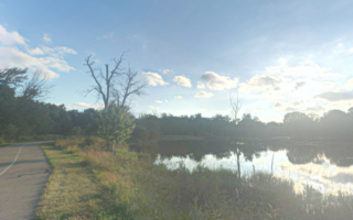
The Lansing River Trail is the anchor of running in Lansing. The paved multi-use trail covers 20+ miles along several waterways, with several distinct sections. This trail map shows the entire trail. For running purposes, we’ve three distinct routes out of the Lansing Trail.
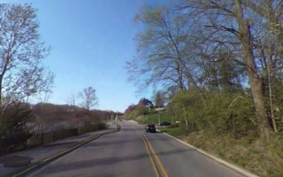
This route covers the main east-west spur of the Lansing Trail, up to 5 miles between Moore’s Park and the MSU Campus. The first 3 miles are along the Grand River and then 2 miles are along the Red Cedar River. There are wonderful views of the water, as this trail passes through several parks. There’s a ~1 mile less pleasant section of trail around the I-496/Highway 127 interchange. The eastern end of this route ends at S Harrison Rd. in the heart of the MSU Campus, near Spartan Stadium, where there’s a running track.
Additional options:
- SOUTH SECTION: At the 3-mile mark, just east of the zoo, there’s a section of the trail that heads south along Sycamore Creek toward Hawk Island Park.
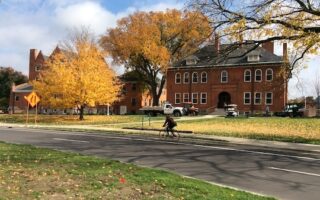
- MSU CAMPUS: At the MSU campus, many miles of pedestrian paths, a running track at Spartan Stadium, and 2 miles along the Red Cedar River on the MSU River Trail/Sanford Woodlot Trail
- NORTH SECTION. From River Point Park to Dietrich Park, including our ‘Capitol’ Spur.
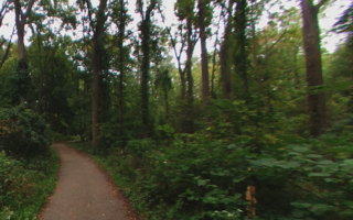
The Lansing River Trail is the anchor of running in Lansing. The paved multi-use trail covers 20+ miles along several waterways, with several distinct sections. This trail map shows the entire trail. For running purposes, we’ve three distinct routes out of the Lansing Trail.
This route covers the main east-west spur of the Lansing Trail, up to 5 miles between Moore’s Park and the MSU Campus. The first 3 miles are along the Grand River and then 2 miles are along the Red Cedar River. There are wonderful views of the water, as this trail passes through several parks. There’s a ~1 mile less pleasant section of trail around the I-496/Highway 127 interchange. The eastern end of this route ends at S Harrison Rd. in the heart of the MSU Campus, near Spartan Stadium, where there’s a running track.
Additional options:
- SOUTH SECTION: At the 3-mile mark, just east of the zoo, there’s a section of the trail that heads south along Sycamore Creek toward Hawk Island Park.
- MSU CAMPUS: At the MSU campus, many miles of pedestrian paths, a running track at Spartan Stadium, and 2 miles along the Red Cedar River on the MSU River Trail/Sanford Woodlot Trail
- NORTH SECTION. From River Point Park to Dietrich Park, including our ‘Capitol’ Spur.


Review or Comment on This Route/Share a Photo!
Share your feedback on this route and see that of other Great Runs users. Click on the image icon to upload a photo. And please let us know if there are notes or changes we should incorporate!