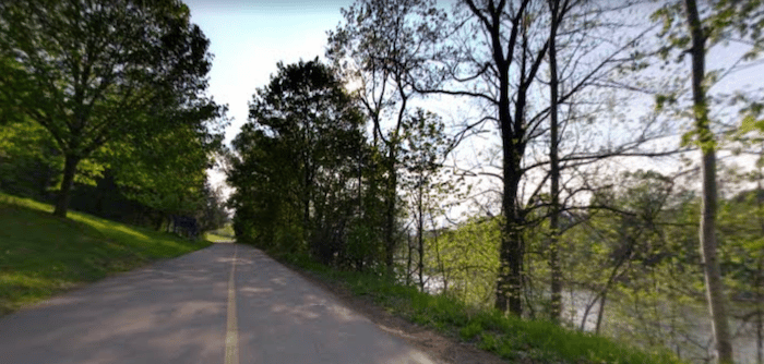
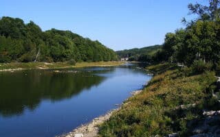
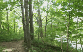
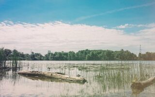
The 30 km of paths along the Thames River are the signature run in London. The path system is beautifully laid out, passing through numerous parks that line the river. The path alternates between sections along the river and other sections through parks and woods. The main, paved path is called the Thames Valley Parkway, though it changes names in some parts and branches out to other tributary paths. The main path system starts near downtown at the Forks of the Thames, and extends for 8 km in each direction. The paths are well way-marked including blue markers every 500m. Note: the path is cleared of snow in winter.
West Route. The main trail heads west for 8 km along the south side of the river to the end of Springbank Park. Includes 2 km through Greenway Park and 2 km through Springbank Park, where there are some additional paths.
East Route. Also starting from the Forks, head east for up to 8 km. The first 3 km alternate between the northern and southern banks of the river, passing through Thames Park, Richard Hanson Park, and Chelsea Green Park. At 3.5 km, cross to the north side using Adelaide St., and run along the north bank, passing through South Branch Park and Vauxhall Park, to Hamilton Rd.
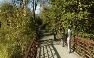
North Route. Another section of the Thames Valley Parkway heads north on the east bank of the river for 3 km to Gibbons Park. Do a quick out and back, or run a loop through Gibbons Park and returning on the path along the western side of the river. [Recommended extra: do a loop around the small but attractive Victoria Park (use Central Ave. at Blackfriars Bridge]. Note: to complete the loop, you’ll have to run over the river using Wharncliffe Rd. (not that attractive).
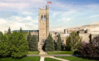
Add-Ons: There are options for numerous distances and combinations. There are additional paths northwest of Gibbons Park, to the University of Western Ontario and then through several parks and preserves.
The 30 km of paths along the Thames River are the signature run in London. The path system is beautifully laid out, passing through numerous parks that line the river. The path alternates between sections along the river and other sections through parks and woods. The main, paved path is called the Thames Valley Parkway, though it changes names in some parts and branches out to other tributary paths. The main path system starts near downtown at the Forks of the Thames, and extends for 8 km in each direction. The paths are well way-marked including blue markers every 500m. Note: the path is cleared of snow in winter.
West Route. The main trail heads west for 8 km along the south side of the river to the end of Springbank Park. Includes 2 km through Greenway Park and 2 km through Springbank Park, where there are some additional paths.
East Route. Also starting from the Forks, head east for up to 8 km. The first 3 km alternate between the northern and southern banks of the river, passing through Thames Park, Richard Hanson Park, and Chelsea Green Park. At 3.5 km, cross to the north side using Adelaide St., and run along the north bank, passing through South Branch Park and Vauxhall Park, to Hamilton Rd.
North Route. Another section of the Thames Valley Parkway heads north on the east bank of the river for 3 km to Gibbons Park. Do a quick out and back, or run a loop through Gibbons Park and returning on the path along the western side of the river. [Recommended extra: do a loop around the small but attractive Victoria Park (use Central Ave. at Blackfriars Bridge]. Note: to complete the loop, you’ll have to run over the river using Wharncliffe Rd. (not that attractive).
Add-Ons: There are options for numerous distances and combinations. There are additional paths northwest of Gibbons Park, to the University of Western Ontario and then through several parks and preserves.

Review or Comment on This Route/Share a Photo!
Share your feedback on this route and see that of other Great Runs users. Click on the image icon to upload a photo. And please let us know if there are notes or changes we should incorporate!