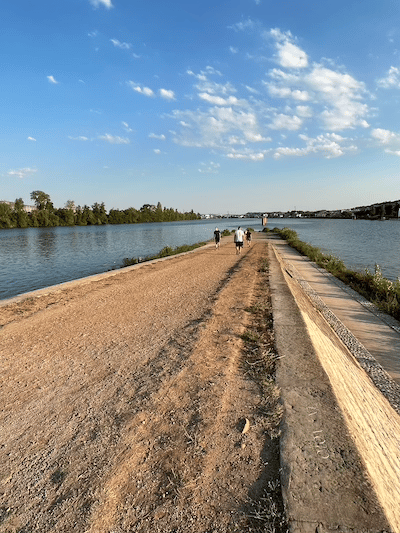
Running along the Rhône River is a classic European river run and one of the better, seamless spots to run in Lyon. The best running is along the east side of the river, where there are paths above the river and alongside it below the road. In some sections the path is called the Berges du Rhône. Starting at one of the central bridges, such as Pont Wilson, head south toward Parc Gerland/Confluence, or north toward Parc de la Tête d’Or. Total path distance is 8.6 km between Parc Gerland and Parc de la Tête d’Or. At Gerland, a nice additional section is to use the pedestrian bridge to the ‘Confluence’ — a historic spot where the Rhône and the Sâone river meet (~ 1 km each way).
Add-On: Combine with the Sâone river paths, which in central Lyon are just 0.5 km west. Also additional paths in Parc de la Tête d’Or. Parc Gerland.
End of path at Confluence. Mark Lowenstein
Some key distances, from the Sports Complex/Gerland Park, heading north (km/mi):
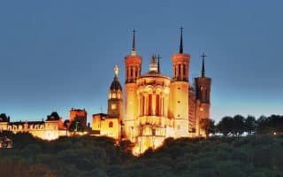
A 10 km 'runseeing' tour of Lyon, incorporating many important sites and buildings, including Vieux Lyon. A highlight is the climb up the Fourvière to the Basilique Notre Dame. After a nice downhill, enjoy a stretch along the Saône River. Note: HILLY!
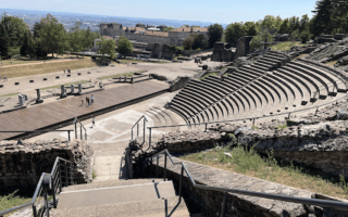
Here's a run we've added to our 'unique' list: the cobbled streets of Old Lyon, a climb up Fourvière to a magnificent basilica, and a jaunt around ancient Roman ruins. Creating your own route combining these three sections, and go early when it's quiet.
Lovely run along one of Lyon's two rivers. There are good paths on both sides of the Saône, from the confluence in the south, through Vieux Lyon, to Pont du Maréchal Koenig, 6.3 km one-way. We've included a table with segment distances.
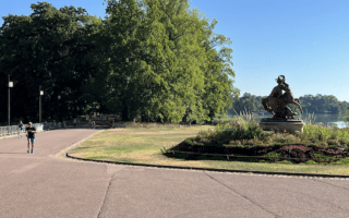
One of the largest urban parks in Europe, and designed on a grand style -- fountains, statues, botanical garden, and many lovely paths and allées. There's a 4 km perimeter 'jogging path', or many other interior paths for a DIY run.
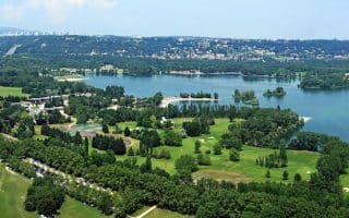
Wonderful park for running, about 10 km east of central Lyon. The running centerpiece is a 10km marked loop around the lake. There are additional spots for running along on some of the park's popular bike paths.
Share your feedback on this route and see that of other Great Runs users. Click on the image icon to upload a photo. And please let us know if there are notes or changes we should incorporate!
Subscribe
0 Comments
Oldest
Newest
Inline Feedbacks
View all comments
Essentials
8.6 km (5.3 miles) one-way
107 feet
South End: Gerland Park; North End: Parc de la Tête d'Or, or any point along the way


Review or Comment on This Route/Share a Photo!
Share your feedback on this route and see that of other Great Runs users. Click on the image icon to upload a photo. And please let us know if there are notes or changes we should incorporate!