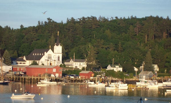
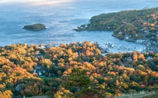
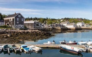
Boothbay Harbor is a quaint coastal town, known for its coastal views, shops and restaurants, and as a departure point for ferries to Monhegan Island and other nearby spots. There are some good options for running in Boothbay Harbor:
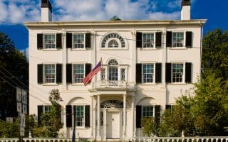
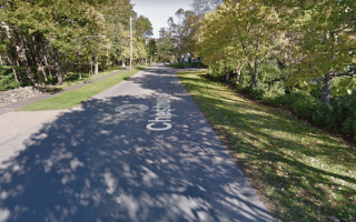
Highlights of Boothbay. This 4-mile route features some pleasant roads around Boothbay Harbor and Lewis Cove, including a 1,000 foot footbridge. Start at the center near the Boothbay Historical Society. Run toward the Harbor, and then bear right following the water on Commercial, Sea, and West streets. Turn around at Middle Rd. at the 1.4 mile mark. Good water views much of the way. Return on West St., then turn RIGHT on Oak St., to the footbridge. Cross to the other side of the Harbor, enjoying the views. You’ll then do a 1.5 mile loop of the eastern side of Boothbay Harbor, and Lewis Cove, following Atlantic Ave., Lobster Cove Rd., and Park St., returning to the start via Union St. and Townsend Ave. MAP
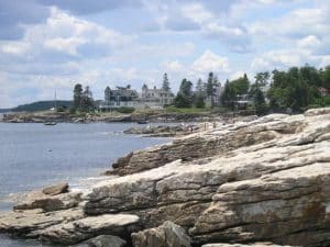
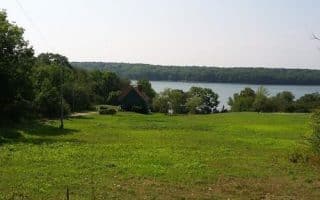
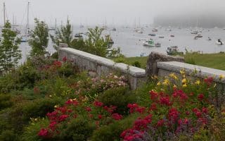
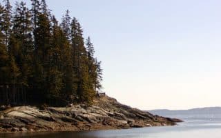
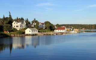
Ocean Point (East Boothbay). Down the next cove is Ocean Point, which has some lovely waterside running and fun rocks for climbing. Park at the parking lot for the Ocean Walk, and enjoy a 2.8 mile there and back along Shore Rd., which features wonderful views out to Card Cove and nearby islands. If you’d prefer a loop, take Van Horne Rd. to Ocean Point Rd. Pre- or post-run, enjoy the rocks of the Ocean Walk, for a scramble or a picnic. MAP
Boothbay Harbor is a quaint coastal town, known for its coastal views, shops and restaurants, and as a departure point for ferries to Monhegan Island and other nearby spots. There are some good options for running in Boothbay Harbor:
Highlights of Boothbay. This 4-mile route features some pleasant roads around Boothbay Harbor and Lewis Cove, including a 1,000 foot footbridge. Start at the center near the Boothbay Historical Society. Run toward the Harbor, and then bear right following the water on Commercial, Sea, and West streets. Turn around at Middle Rd. at the 1.4 mile mark. Good water views much of the way. Return on West St., then turn RIGHT on Oak St., to the footbridge. Cross to the other side of the Harbor, enjoying the views. You’ll then do a 1.5 mile loop of the eastern side of Boothbay Harbor, and Lewis Cove, following Atlantic Ave., Lobster Cove Rd., and Park St., returning to the start via Union St. and Townsend Ave. MAP
Ocean Point (East Boothbay). Down the next cove is Ocean Point, which has some lovely waterside running and fun rocks for climbing. Park at the parking lot for the Ocean Walk, and enjoy a 2.8 mile there and back along Shore Rd., which features wonderful views out to Card Cove and nearby islands. If you’d prefer a loop, take Van Horne Rd. to Ocean Point Rd. Pre- or post-run, enjoy the rocks of the Ocean Walk, for a scramble or a picnic. MAP
Scroll Down For Route Maps
Essentials
Boothbay Harbor Main Loop: 4.1 miles; Ocean Point: 2.8 miles there and back on Shore Rd.
Boothbay Route: 301 feet; Ocean Point Route: 38 feet
Boothbay Route: Historical Society; Ocean Point Route: Parking lot for Ocean Walk off Rt. 96
There are good running options in the Brunswick area. A 5-mile downtown tour features 3 bridges, historic buildings, and pretty waterfront paths. The Bowdoin campus is a treat. We also love the Town Commons Trails and Crystal Springs Farm Trails.
This historic shipbuilding town has some excellent running. We've plotted a 5-mile waterfront route, including sections of downtown, and a 7.4 mile loop out to North Bath and looping back on the Whiskeag Trail. Additional routes in nearby Brunswick.
One of the longer stretches of sand beach on the mid-Maine coast, and good for running. Pleasant road running out to Fort Baldwin and Hunnewell Point, with great water views. A full 'loop' of the peninsula is about 7 miles.
Known as “The Prettiest Village in Maine,” Wiscasset is a choice town for a residential/commercial run with an old timey seaport feel. We've mapped out a gorgeous 5-mile run highlighting Wiscasset and over the bridge to Fort Edgecomb State Park.
We've put together two great runs in this historic fishing village: A jaunt along the Harbor Path and quaint Main St., with its shops, restaurants, and galleries; And a route out to Breakwater Light, where you can run on large granite rocks for 0.7 miles to the lighthouse.
St. George is one of the quieter spots along the Maine mid-coast. There's no signature coastal town, but the roads in this area are quiet, pastoral, and great for running. We've put together two easy-to-follow loop options of 7.2 and 11.4 miles.
Rockport is the smaller cousin of Rockland (to the south) and Camden, which is 2 miles north. We've put together a route highlighting the prettiest streets of central Rockport and its harbor.
A 5-mile loop between the popular towns of Rockport and Camden. Lovely New England homes, occasional water views, and pleasantly shaded. This fairly hilly route mainly involves Bayview Ave. and Chestnut St. Good add-on opportunities at each end.
Lovely coastal town, located on Penobscot Bay at the mouth of the Megunticook River, with Mount Battie rising above. Nice running in town, to Rockport, and 30 miles of trails in Camden Hills State Park.
This beautiful island is located just off of Maine’s mid-coast, accessible by ferry from Camden. Great for running in the Penobscot Bay, with quiet roads, pretty foliage, and nice water views. We've mapped a 7 mile loop from the ferry terminal.
Create your own route in this historic seaport town. A highlight is the 1 mile Harborwalk and footbridge. Then, enjoy some of the main streets downtown, which feature historic buildings and fun restaurants and shops.
A charming midcoast Maine spot offering cozy inns, scenic views, and plenty of history. We have put together two routes for running in Castine, featuring its elm-lined main streets, waterfront roads, and trails in Witherle Woods.
A pleasant 5-mile out and back run along the water from the center of this island town in the Penobscot Bay. Nice water views along Greenhead Rd. and Sand Beach Rd., with a short detour to Moose Island.
This lobster fishery and summer colony, reachable via a 75-minute ferry from Rockland, features 50 miles of traffic-free roads. We've put together a 4-mile waterfront loop, and a 9-mile 'round the island' loop.
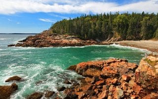
The Park Loop Road is great for running, especially the 5 mile section between Seal Beach and Little Hunters Beach. The Carriage Roads are special for running, with many options. And for a true challenge, run up Cadillac Mountain!
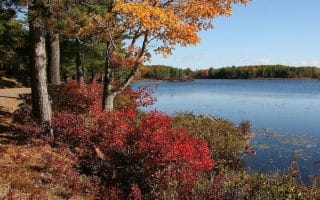
You don’t have to be a serious trail runner to enjoy the backcountry views in this National Park. Acadia has 45 miles of wide, well-groomed carriage roads that are perfect for a refreshing fall run. Fantastic option in the fall.
Known as “The Prettiest Village in Maine,” Wiscasset is a choice town for a residential/commercial run with an old timey seaport feel. We've mapped out a gorgeous 5-mile run highlighting Wiscasset and over the bridge to Fort Edgecomb State Park.
Share your feedback on this route and see that of other Great Runs users. Click on the image icon to upload a photo. And please let us know if there are notes or changes we should incorporate!
Subscribe
1 Comment
Oldest
Newest
Inline Feedbacks
View all comments
Essentials
Boothbay Harbor Main Loop: 4.1 miles; Ocean Point: 2.8 miles there and back on Shore Rd.
Boothbay Route: 301 feet; Ocean Point Route: 38 feet
Boothbay Route: Historical Society; Ocean Point Route: Parking lot for Ocean Walk off Rt. 96
 Ocean Point (East Boothbay). Down the next cove is Ocean Point, which has some lovely waterside running and fun rocks for climbing. Park at the parking lot for the Ocean Walk, and enjoy a 2.8 mile there and back along Shore Rd., which features wonderful views out to Card Cove and nearby islands. If you’d prefer a loop, take Van Horne Rd. to Ocean Point Rd. Pre- or post-run, enjoy the rocks of the Ocean Walk, for a scramble or a picnic. MAP
Review or Comment on This Route/Share a Photo!
Share your feedback on this route and see that of other Great Runs users. Click on the image icon to upload a photo. And please let us know if there are notes or changes we should incorporate!