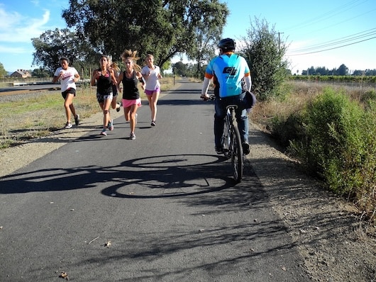
In Napa, there The Napa River Trail and Napa Valley Vine Trail make for some good off-road running options and can be combined in various ways. The Napa Valley Vine Trail is the more ambitious of the two, with progress being made on its 47 mile completion!
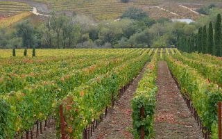
Napa Valley Vine Trail. This paved multi-use rail trail, which follows SR 29 for much of the way, is being built in sections. Ultimately, it will run for 47 miles between Vallejo and Calistoga. There are some lovely sections, passing through park and by vineyards. As of early 2026, ~27 miles are completed. It is almost continuous from Vallejo to Yountville. We’ve mapped the three completed sections, from south to north. See this LINK for updated construction information. TRAIL MAP (completed & planned sections). There are kiosks with trail maps along the way.
- Vallejo to American Canyon. 6.3 miles. Starting at Independence Park in Vallejo, the southern 4 miles are especially scenic, along the Mare Island Strait and crossingn the Napa River. Some nice water views. Miles ~4-6.3 mainly follow SR 29, to American Canyon Rd.
- There are a couple of gaps/on-road sections between American Canyon Rd. and John F. Kennedy Memorial Park.
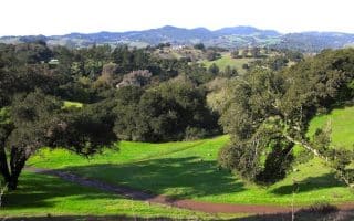
- Napa City North to Yountville. 12.5 miles. This section starts at John F. Kennedy Memorial Park, headed north. The southern 3 miles are really nice, through the park and along the river. Then 2 miles along Soscol Ave. and along an old rail line. From Mile 5.6 @Redwood Rd., the trail parallels HWY 29 and is not as scenic. Running Track @Napa High School.
- Challenge/Trail Run Option: See our River to Ridge Trail route, which can start in Kennedy Park.
- @Lincoln Ave. in Napa, you can head east for 0.6 miles to pick up the Napa River Trail (see below).
- GAP: Between Yountville and St. Helena, which is the last major section still to be completed.
- St. Helena to Calistoga. This 8.2-mile section of trail was completed in 2024. It’s mainly along SR 29, so not that bucolic. At Mile 3, there’s a nice section through Bothe-Napa Valley State Park, where you can veer onto the History Trail or detour to other trails in the park. The northern 2 miles leave SR 29 and follow the Washington St. Bike Path along the Napa River into Calistoga.
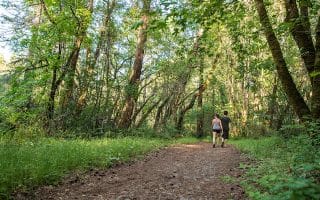
Napa River Trail. This paved multi-use path runs along the Napa River just north of downtown Napa City for 1.4 miles from Lincoln Ave. to Trancas Crossing Park. It’s a pleasant scenic path, some of it wooded. At Trancas Crossing Park, there’s an 0.6 mile loop path around the park.
- Longer Option: connect to the Napa Valley Vine Trail @Lincoln Ave., 0.6 miles to the west.


Review or Comment on This Route/Share a Photo!
Share your feedback on this route and see that of other Great Runs users. Click on the image icon to upload a photo. And please let us know if there are notes or changes we should incorporate!