Features:
Categories:
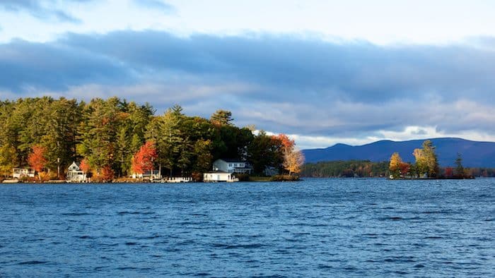
Lake Winnipesaukee: This massive lake, situated in the center of New Hampshire, is a favorite of foliage viewers for its expansive water views, revealing color changes on the chain of forested islands which dot the lakes region. Even on a map, it’s hard to comprehend just how huge the 71 square mile lake is, but it offers up a variety of quiet back roads from which to enjoy the colorful lakeside scenery. Lots of runners favor 2.5 mile long Sewall Road in Wolfeboro (one of the year round hubs for tourism in the Lakes Region.) As traffic is light in fall, the shoulder is adequate, and you’ll get amazing views of the village, beaches, boats bobbing in Wolfeboro Harbor, and some of the grand homes in the neighborhoods bordering the lake. A nice 4-mile nice incorporates Sewall Rd., Forest St., and N.Main St. (Rt 109). ROUTE MAP
Another good option is the Cotton Valley Rail Trail, which cuts through Wolfeboro on the Eastern side of the lake. The trail runs for 11 miles between Wolfeboro and Rt. 16 in Wakefield, but the most ‘runnable’ part is 6.2 miles from downtown Wolfeboro to East Wolfeboro. A good 4 mile out and back is from Wolfeboro to Albee Beach. The highlight is the two long causeways along Lake Wentworth and Crescent Lake.
Cotton Valley Rail Trail Information Cotton Valley Rail Trail Sewall Rd. Route MapFor runners on the other side of the lake, the expansive views along the aptly named Scenic Roads, (two of them) near Weirs Beach and Glendale, make for rewarding routes.
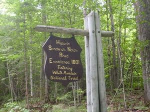 Squam Lake/Waterville Valley Area: Sandwich Notch Road: Where Squam Lake rises up to meet the Waterville Valley, this 11 mile dirt road runs from Route 113 in the center of Sandwich to Route 49 which continues up to the ski resort. Though you won’t see great lake vistas here, the “Notch Road” is a nearly traffic-less hill with a soft surface. And this route is about as rural as they come — in winter, it’s closed to cars except for a series of dog-sled races. If you’re feeling extra-energetic, you can branch off and enjoy one of the many single-track trails that link to the Notch Road. To get there, follow Grove Street north out of Sandwich until it turns into Diamond Ledge Road. Park your car on Grove, and run up Diamond Ledge about two miles. Just after the top of the hill, Diamond Ledge becomes Sandwich Notch Road. If you run all the way to the end of Sandwich Notch, you’ll gain 900 feet of elevation in a little over five miles!

Comment on this Route/Share a Photo!
Share your feedback on this route and see that of other Great Runs users. Click on the image icon to upload a photo. And please let us know if there are notes or changes we should incorporate!