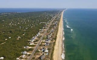
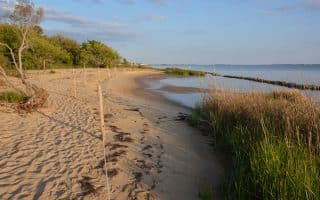
Roanoke Island, site of the Lost Colony and the pretty, bayside town of Manteo, has some good running options. It’s reached by bridge from Whalebone Junction.
Wikimedia Commons
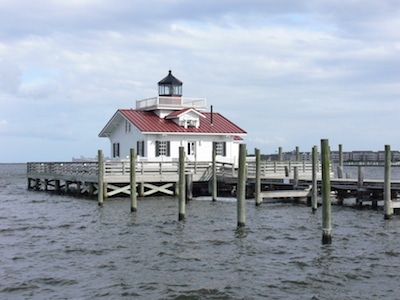
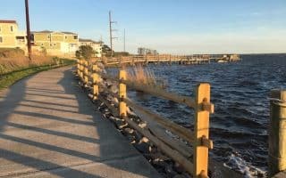
Manteo Tour. We’ve mapped a pleasant tour consisting of the town’s pretty streets and sections along the water. Just of Rt. 64, Glenville St. leads to a 1/2 mile very pretty wooden boardwalk that has great water views. Then, head down to Festival Park and Sandy Point. The next section is inland a bit along 1121, past the high school, where you’ll then do a nice 1-mile waterfront run along Mother Vineyard Rd. Return to Manteo, and enjoy the pretty streets of Old Town. Can be shortened by starting right in Manteo or eliminating the Mother Vineyard section.
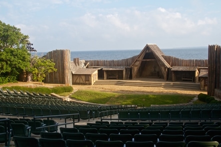
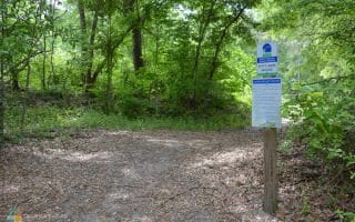
Fort Raleigh National Historic Site protects and preserves known portions of England’s first New World settlements from 1584 to 1590. Located at the tip of Roanoke Island, near the North Carolina Aquarium. One can put together a pleasant 3-4 mile run here, combination paved and trails through a maritime forest. This includes the 1.25 mile Freedom Trail, which leads to North Park and great water views. Another treat is the Elizabethan Gardens, a historic Botanical Garden.
Longer Option: Connect our Manteo and Fort Raleigh runs by running along Rt. 64 (decent sidewalk/bike path) for 2.1 miles from Mother Vineyard Rd.
Roanoke Island, site of the Lost Colony and the pretty, bayside town of Manteo, has some good running options. It’s reached by bridge from Whalebone Junction.
Wikimedia Commons
Manteo Tour. We’ve mapped a pleasant tour consisting of the town’s pretty streets and sections along the water. Just of Rt. 64, Glenville St. leads to a 1/2 mile very pretty wooden boardwalk that has great water views. Then, head down to Festival Park and Sandy Point. The next section is inland a bit along 1121, past the high school, where you’ll then do a nice 1-mile waterfront run along Mother Vineyard Rd. Return to Manteo, and enjoy the pretty streets of Old Town. Can be shortened by starting right in Manteo or eliminating the Mother Vineyard section.
Fort Raleigh National Historic Site protects and preserves known portions of England’s first New World settlements from 1584 to 1590. Located at the tip of Roanoke Island, near the North Carolina Aquarium. One can put together a pleasant 3-4 mile run here, combination paved and trails through a maritime forest. This includes the 1.25 mile Freedom Trail, which leads to North Park and great water views. Another treat is the Elizabethan Gardens, a historic Botanical Garden.
Longer Option: Connect our Manteo and Fort Raleigh runs by running along Rt. 64 (decent sidewalk/bike path) for 2.1 miles from Mother Vineyard Rd.
Scroll Down For Route Maps
Essentials
Mateo tour is a flat 6.3 miles (10 km). Fort Raleigh has 3-4 miles of road/trail
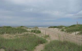
The northernmost town in the Outer Banks has good running options. A 'Corolla Tour' of nearly 5 miles features an ocean-side path, and historic Park with paths to an old mansion and lighthouse. 4+ mile multi-use path along Hwy 12.
Duck is one of the swankier and more popular OBX towns. Good combination of boardwalk and section of Highway 12 heading north, with good water views. Some quieter running in and out of the residential side streets between Hwy 12 and the beach.
One of the widest sections of the Outer Banks, with several good running options: pretty residential off Rt. 12 features the area's nicest homes; the 3-mile Dogwood Trail, passing along a golf course; bike path alongside Highway 12; and beautiful beach.
Good off-road running opportunities at the mid-point of the Outer Banks. The Reserve has roads and trails through maritime forest, marshes, and brackish swamplands. There's a multi-use trail, path alongside Woods Rd., more rugged through the woods.
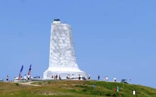
A pleasant run on quiet waterfront roads along Kitty Hawk Bay. There are numerous distance options, but the highlight is the section along the water, using Morse Shore Rd. to Bay Rd., which can be followed for 5+ miles to the Wright Brothers Memorial.
Fly as fast as the Wright brothers at Kitty Hawk! The Memorial site has 2-3 miles of pleasant paths that make for a unique and historic run. We've added a mile along Colington Creek to make this a 5.5 miler, nearly all on paths.
Run through sand dunes, ponds, marshes and wetlands in this 1,000+ acre preserve that is a National Natural Landmark. Near Nags Head & Wright Bros. Memorial. 5 miles of trails, lots of variety and different surfaces in this maritime forest preserve.
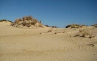
Run the tallest living sand dune on the Atlantic Coast! Numerous hilly paths, including the challenging 'Tracks in the Sand' Trail, through soft sand, in Jockey's Ridge State Park. Can combine with Soundside Nature Trail, which opens onto wetlands, and grassy dunes.
Our guide to some of the best places to run in the Cape Hatteras National Seashore. Beaches, trails, and some of the better road options on its three islands: Bodie Island, Hatteras Island, and Ocracoke Island.
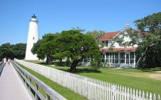
The outermost part of Cape Hatteras National Seashore is only reachable by ferry. For runners, that means lack of cars and quiet roads. We've mapped a nice loop around the southern part of the island, with nice water views, Lighthouse, historic sites.
Share your feedback on this route and see that of other Great Runs users. Click on the image icon to upload a photo. And please let us know if there are notes or changes we should incorporate!
Subscribe
0 Comments
Oldest
Newest
Inline Feedbacks
View all comments
Essentials
Mateo tour is a flat 6.3 miles (10 km). Fort Raleigh has 3-4 miles of road/trail
Review or Comment on This Route/Share a Photo!
Share your feedback on this route and see that of other Great Runs users. Click on the image icon to upload a photo. And please let us know if there are notes or changes we should incorporate!